Reminiscences on Densifying Vertical Control
in the Great Sandy Desert in 1975
Laurie McLean, October 2006
In 1975, one task was to spot photograph unmarked benchmarks in the Canning Basin/Great Sandy Desert region of Western Australia. The BMs and associated level traverses were established some years beforehand (in the late 1960s/early 1970s as I now recall). Bench marks were placed about every 5 miles along the level traverses. Each mark comprised a 4 inch diameter brass plaque in a surrounding white concrete collar that protruded about 6 inches above the ground. A white painted star picket (fence dropper) that protruded 3 or 4 feet above ground level was a witness post placed at each mark to assist with on the ground location.
The task was to photograph as many bench marks as could be readily identified from the air. This would allow transfer of identified marks on to 1:80,000 scale mapping photography for densification of vertical control. This additional control supported the 1:100,000 scale national topographic mapping program.
NatMap people engaged in field task were:
· Andrew Turk, Senior Surveyor (navigator/oblique camera operator)
· Ted Rollo, Technical Officer (vertical camera operator/photography technician)
· Hayden Reynolds, Technical Assistant (logistical support and heavy support vehicle operator)
· Laurie McLean, Technical Officer (logistics and relief navigator).
Dick Coxon, an experienced Kalgoorlie based pilot operated the chartered aircraft.
Principal equipment was:
· Single engine Cessna 182 fixed wing aircraft (VH-DXC) with floor cut-out for vertical camera mounting
· Hasselblad 70mm camera (for vertical shots of BMs )
· Nikon 35mm camera (with zoom lense for oblique area shots of each BM at differing scales to assist identification on 70mm photography prior to transfer onto mapping photography)
· 1:250,000 scale R502 topographic maps and 1:80,000 scale b&w vertical aerial photography for navigation to and along the level traverses.
Support vehicles were:
· ZSU 458 International D1600, 6 cylinder petrol engined 4X4 truck with nominal 3 ton payload
· ZSN 172 Landrover 109" wheelbase, 4 cylinder petrol engined 4X4 van.
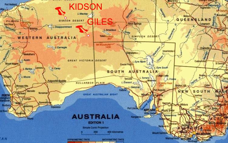
From 3-11 September 1975, flying operations were based from Kidson Field (22º 41' South 125º 04' East) in the Canning Basin the Gibson Desert about 34 miles south-east of Well 33 on the Canning Stock Route. From 13-16 September, flying was based from Giles Weather Station (25º 02' South 125º 18' East) in the Rawlinson Range to the north-west of the junction of the NT/SA/WA borders (refer map below).
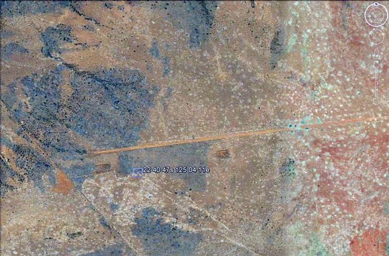
Kidson can still be seen clearly on Google Earth as shown above – Ed.
About a month before flying commenced, Hayden and I left NatMap's Melbourne office in the support vehicles. Our initial task was to ferry in aircraft and vehicle fuel and water supplies and establish a fly camp at Kidson to support operations. The journey from Melbourne to Kidson was through Adelaide, Kalgoorlie, Newman and Marble Bar, a distance of over 3,200 miles. Most of the final 500 miles was over little used station and oil exploration tracks through the remote desert country.
The fly camp was established during the week ending 30 August 1975. This task included clearing regrowth from the airstrip (last used by NatMap in 1972 as a base for Aerodist measuring operations). The clearing was initially achieved by dragging a sheet of chain link fence mesh behind a vehicle. The mesh was attached to and carefully weighted by dead mulga branches to achieve the desired cut. However, many remaining tufts had to be hand cleared with pick and spade. A windsock was erected to assist aircraft landings and take-offs.
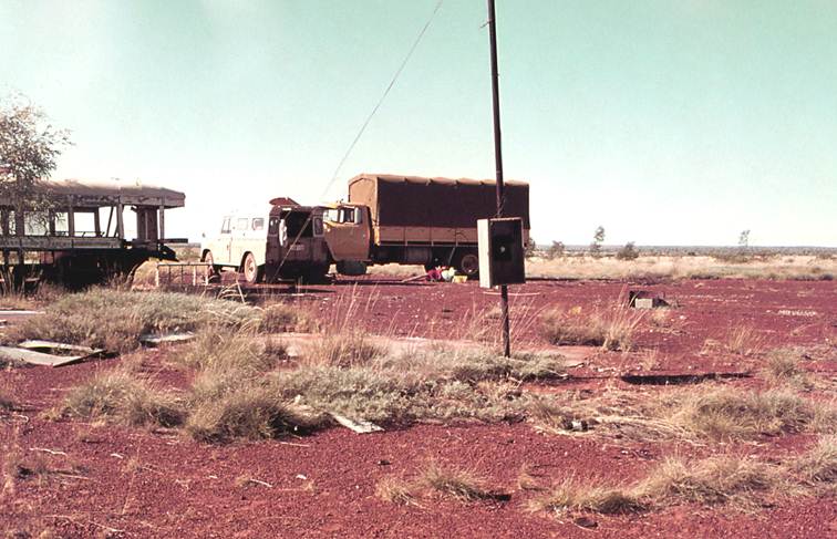
Photo 1- Roadside camp at the junction of the Calawa and Sahara tracks (20º 36' South
121º 09' East) on 21 August 1975 about 360 miles north-west of Kidson.
It was a camp site during construction of the Sahara track in the mid-1960s, hence the abandoned semi trailer bus.
Note the post phone on the Calawa Creek telegraph line that still provided a reverse-charge service.
Essentially, the flying operation involved taking vertical spot photographs of each bench mark with the 70mm camera at 3 levels: 3,000, 1,500 and 500 feet above the terrain. After the 500 feet vertical shots were taken, the aircraft would circle the benchmark to allow the navigator to take several oblique photographs using the 35mm camera. Having navigated to the start of a level traverse using topographic maps and aerial photographs, it was often possible to follow the old wheel tracks to the next bench mark. Ferrying between marks along the traverses was done at whatever height the aircraft was at. For example, having completed work at one bench mark at 500 feet, the aircraft would ferry at that height to the next mark and then progressively ascend during photography operations to 3,000 feet and travel at that height to the next mark. In general, the work was very intense for the air crew, particularly as the Cessna had an endurance of over 5 hours.
Fortunately, Andrew and Ted did most of the flying. However, on a couple of days Andrew asked me to relieve him as navigator. On these occasions we flew over level section 1648-1649 that ran to north-east of Kidson in the direction of Balgo. For me these days were pretty intense but generally uneventful. However, towards the end of one afternoon it was hot and the aircraft was often buffeted by thermals. I remember getting the Nikon ready for oblique shots at one bench mark and noticing a large solitary camel nearby. As if this distraction was not enough, with the aircraft tilted on one wing fairly close to the ground it was buffeted badly by a thermal and the pilot made some pleasant remarks as he fought to regain control. During all of this I lost my reference point for the bench mark and could do no more than click the Nikon in its general direction. (Back in the office some months later I was keen to find out from Steve Pinwill how the task of identifying the bench marks on the 70mm photography and transferring them to the mapping photography had gone. Steve indicated that most had been successfully transferred but the obliques at one bench mark seemed to be somewhat astray. He couldn't even see the camel!)
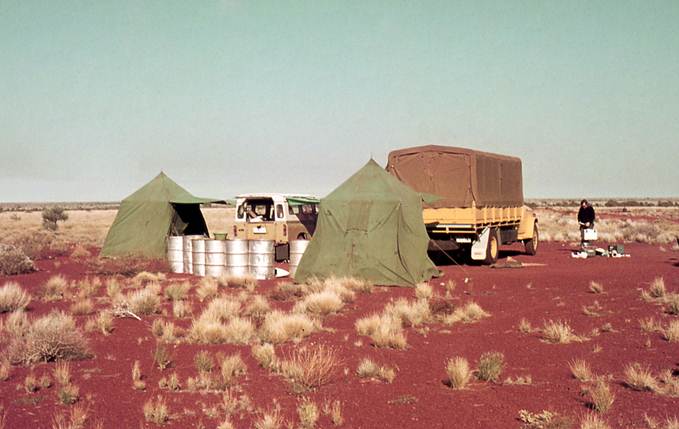
Photo 2 - The 1975 Kidson fly camp with Andrew Turk checking some paperwork.
Note placement of Kimberley tents, vehicles and empty fuel drums to maximize shelter from
prevailing westerlies.
In small but intense field operation such as this one, good relationships between party members are essential. Fortunately, we were a happy and harmonious crew who, apart from the pilot, had all worked together in the field on many previous occasions. Although new to us, Dick was a very competent and experienced pilot who readily and naturally fitted in around the camp.
After the evening meal on the night of the camel incident we sat around our small camp fire discussing the day's events. I asked Dick about survival chances if the aircraft had gone in or if its engine should quit on some later operation. After taking another mouthful of camp coffee, Dick soberly philosophised along the following lines: Hopefully I can get ground speed down to about 45 mph before we hit and with a bit of luck can guide it between a couple of mulgas to knock the wings off. This way there will be less risk of fire as the nose wheel digs in and we flip over on the soft sand. So we should survive. But if otherwise...well, we're all over 25 now and know about the world, its people, its continents, the mountains and the oceans as well as about love and other mysteries of life. You have to realize that from here on it's all going to be repetition!
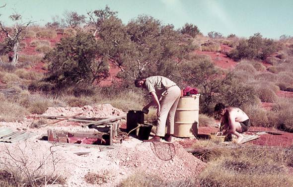
Photo 3 - Andrew Turk and Ted Rollo drawing water in the Gibson Desert on 6 September 1975
Ted was a personal friend who had kindly officiated as best man at my wedding the previous December, I recall him remarking that my widow may not see it Dick's way. Fortunately, Andrew did the rest of the navigating from Kidson. (I was greatly saddened to learn of Ted's untimely passing some two decades later.)
In the desert particularly, water is always a scarce resource so one Saturday afternoon, Ted Andrew and I travelled in the Landover to locate a reported new CSIRO well. We found it about 12 miles to the south-east of Kidson on the east side of the track to Windy Corner. It was at the northern edge of the only belt of (generally east-west) sand ridges between Kidson and Everard Junction (on the Gunbarrel Highway to the south of Windy Corner).
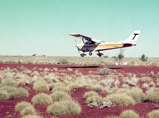
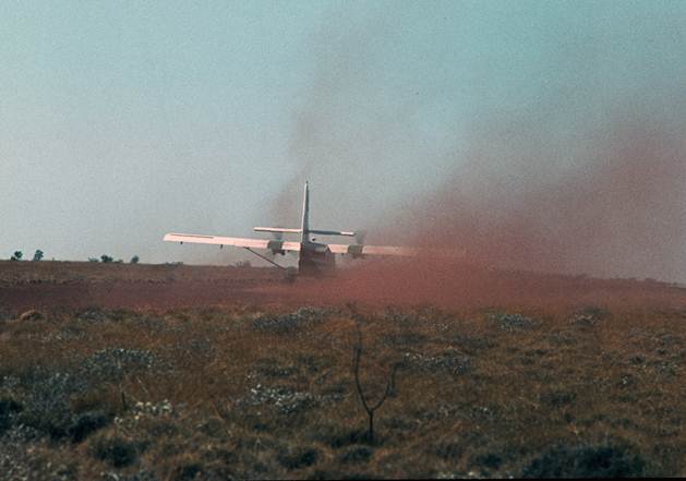
Photo 4 - Pilot Dick Coxon landing Cessna VH-DXC at Kidson Field in September 1975. Note the
port wheel spat was removed as a safety measure due to problems with its mounting bracket
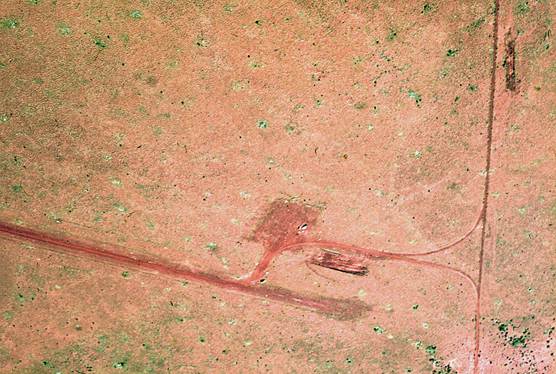
Photo 5 - Kidson Field September 1975
Shifting flying operations from Kidson to Giles required careful coordination to ensure continuity of logistical support. Accordingly, Hayden departed alone on 9 September in the heavy support vehicle to get aircraft fuel supplies in place while the rest of party continued to operate from Kidson. For Hayden this involved a journey of nearly 500 miles on unmaintained desert tracks through some of the remotest country in Australia. Hayden had not previously travelled this route that went south through Windy Corner, past Young Range to Everard Junction then east along the so called Gunbarrel Highway to Jackie Junction and finally north and north-east through the confused sand hills near Lake Christopher to Giles. He arrived at Giles on time with vehicle and load intact.
However, the trip was not without incident. As he drove toward Everard Junction, Hayden detected a strong smell of petrol. Although the International was running alright, he though it prudent to stop and investigate. Just as well. He soon discovered that a petrol drum was leaking near its base and much of the floor of the truck's tray was awash with the volatile liquid. To his great credit, Hayden quickly attended to the matter unassisted and soon proceeded on his journey. Having had considerable practical experience in the construction industry, he apparently took this potentially dangerous incident in his stride as just one of those things that can happen in the bush.
After the aircraft departed Kidson on 11 September, I dismantled and packed up the camp and departed for Giles in the Landrover the next morning. I followed the same route as Hayden but had the advantage of having travelled it a number of times before (in 1972). Nevertheless, I had to deal with a situation I had not previously encountered in that country. Although 12 September was a cloudless day, just south of Windy Corner the track suddenly became a water course. It had rained before I arrived, probably overnight given the sunny sky. My dilemma was that the country I had to travel was a gravelly plain whose only features were spinifex and mulga. There was no high ground for a suitable stopping place. All I had to guide me forward was the sheet of water over the track contained between banks of spinifex. It was like driving down a still stream. While I could rarely see the track surface, it was fortunately quite firm. Owing to the absence of track surface visibility, progress was slow. When trackside vegetation indicated a likely drainage course I proceeded at walking pace. I travelled in this manner non-stop from late morning until just on dusk and covered about 100 miles. I reached high ground at Young Range just as it was getting too dark to continue. The next day was fine and sunny and the track was dry. I travelled on to Giles without further incident. These things just happen in the bush.
Photo 6 - Hayden Reynolds at Mount Anderson, WA in 1974
Post script (Ed.)
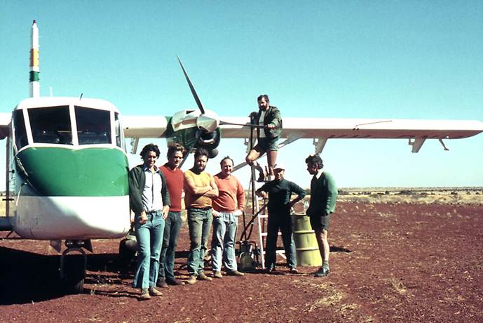
Kidson was used for other Natmap airborne operations from time to time during the 1970s . The following two photos taken in July 1977 show Natmap’s Nomad (VH-DNM) landing to refuel and the air and ground crews (L-R : Derkacz, McLean, Maginn, Wise, Ertok, O’Donohue [Contract pilot] & Lawrence [on the ladder].
Laurie has been back to Kidson several times since the events in this article, namely 1977 and more recently 2007 & 2010.
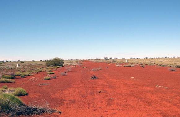
The following photos show the strip and Laurie using the latest technology (satellite phone) to communicate with the outside world whilst there in August 2010.
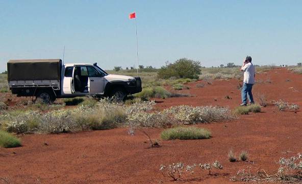
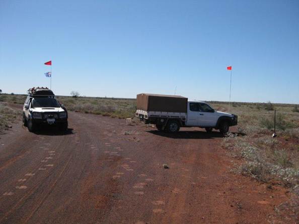
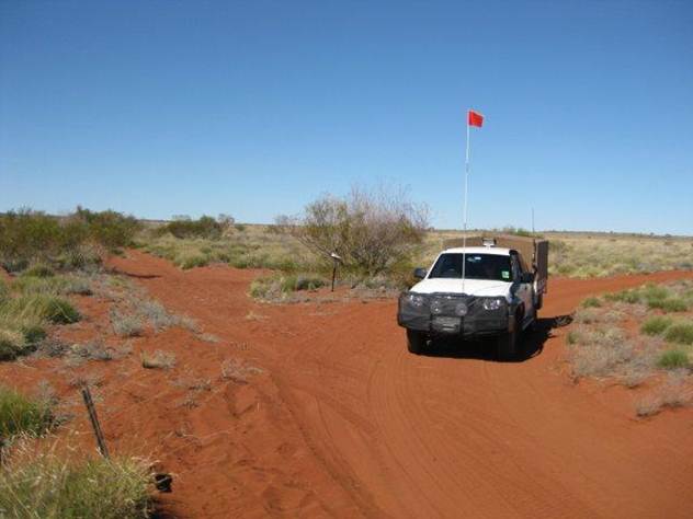
Laurie McLean's and Dave Uren's vehicles turning north on to Gary Highway at southern end of Wapet's Kidson Track (about 12k south-east of Kidson airstrip) on 3 August 2010.
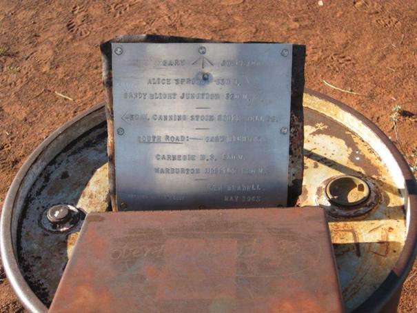
Replica plaque at Gary Junction at the intersection of the so called Gary Highway (that runs north from Young Range to here) and the so called Gary Junction Road (the western end of which was initially built along the 1961 wheel tracks of NatMap surveyors HA Johnson and OJ Bobroff who together with Bob Goldsworthy travelled from Jupiter Well to Well 35 and were the first to reach Well 35 by vehicle). WRE's senior technical officer Len Beadell led the party that later constructed both the Highway and the Road to meet NatMap's geodetic survey access requirements.
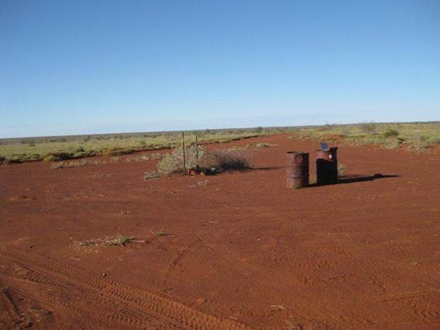
Looking east at Gary Junction about 28 km north west of Kidson airstrip 3 August 2010.
At intersection of Well 35 to Gary Junction track (left) and Canning Stock Route track; about 4km south of Well 35 on 5 August 2010.
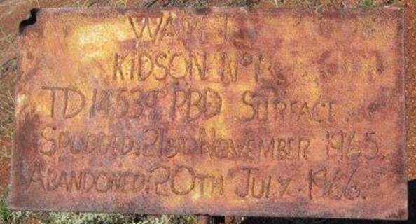
At the Kidson No 1 oil well site (22 36.79 S 125 00.3 E) about 9 k north-west of Kidson airstrip on 3 August 2010. Transporting and maintaining the equipment and workers for the sinking of this 14,500 feet deep well was the reason for building the Wapet Sahara (Kidson) track and the nearby Kidson airstrip in the mid-1960s.
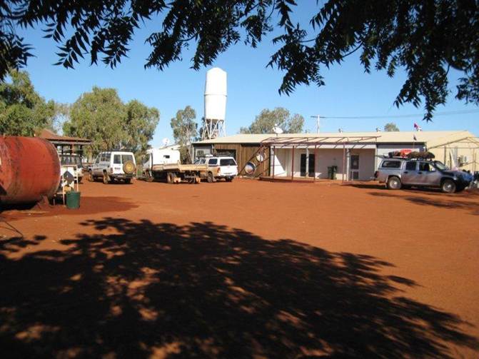
Store and fuelling point at the Kunawarritji Community (established from early 1980s) about 8km from Well 33 and about 55km north west of Kidson airstrip (image taken 4 August 2010).