Mapping Control Survey Archipelago of the Recherche aka Mondrain Island Survey
by Paul Wise
I originally wrote this article for a 1984 edition of the Dandenong Nat Map News. I have briefly added to that article but mostly it is unchanged. The photos and the map, however, are all new.
The survey was undertaken by a group from Canberra plus myself, from Dandenong, so that any changes to the control location required by Dandenong for the aerotriangulation, could be agreed on the spot.
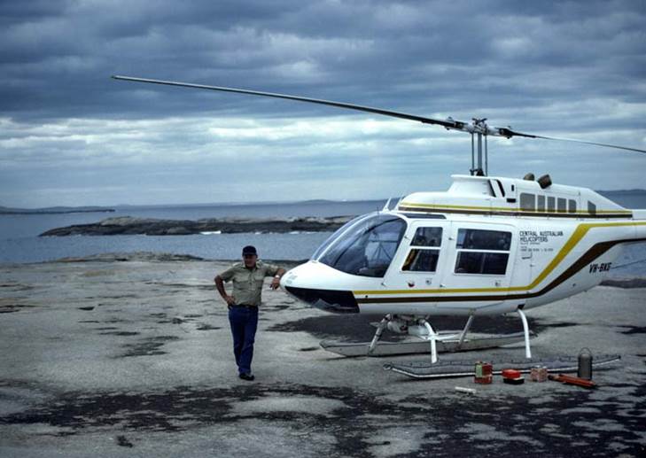
Brian Murphy was Party Leader, with Frank Blanchfield, Noel Templeman, Steve Yates, Tom Mueller, Geoff Starkey (Electronics), and myself making up the seven. Graeme Hill-Smith was the contract helicopter pilot.
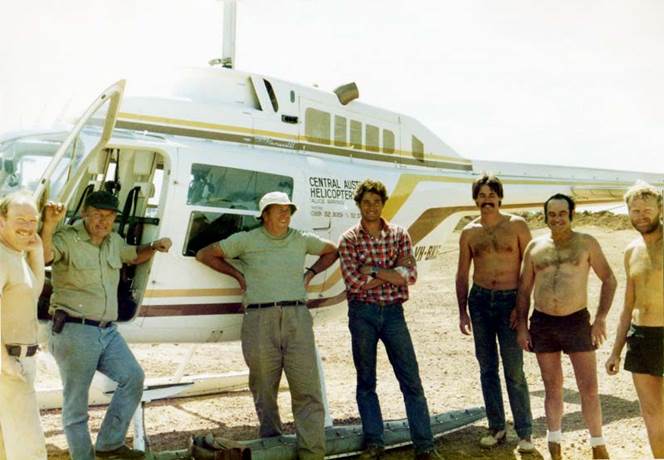
Frank
Blanchfield at Tagon Point and the rest of the survey party Paul Wise, Graeme
Hill-Smith, Brian Murphy, Steve Yates, Geoff Starkey, Noel Templeman, Tom
Mueller (thanks to Steve Yates for finding this photo taken by Frank Blanchfield).
The highlight was being choppered out to Termination Island, some 50km offshore, to set up the equipment. The views of the islands and reefs were spectacular. Although it was a little scary knowing that if we kept heading south, next stop was Antarctica!!
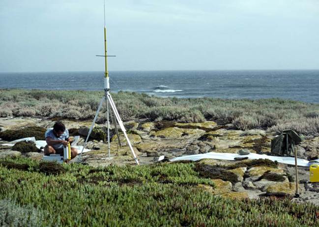
As well as satellite positioning equipment another concession to a speedy project was having a 240 volt generator. As all the control points were to be established on rock, this allowed a power drill to be used to make the holes to take lead plugs with tags, on which was stamped the station details. Station marking, therefore, was done by the time the satellite positioning equipment was set up.
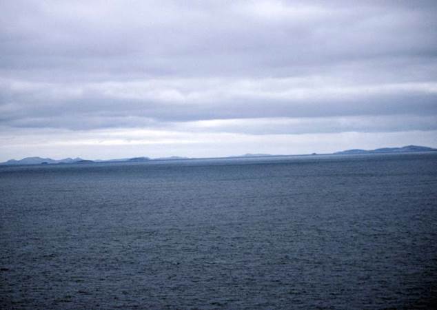
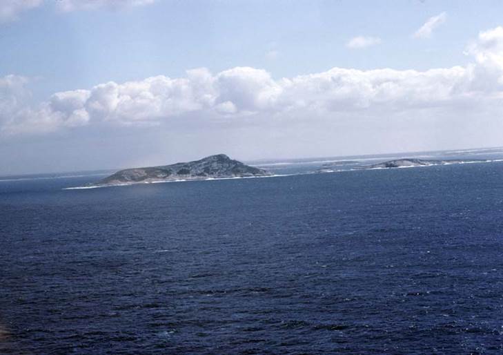
The
“mainland” from Termination Island and “on-approach” to Termination Island
MONDRAIN - THE LAST ISLAND SURVEY
Mondrain Island is the biggest island in the Archipelago of the Recherche named by the French when French admiral, Joseph-Antoine Raymond de Bruny d'Entrecasteaux (pronounced don-truh-cast-oh, with slight stress on the last syllable) and his 2IC anchored off what is now the town of Esperance with two ships the "Esperance" and the "Recherche" in 1798. The “Recherche” was under the command of d'Entrecasteaux, and the “Esperance”, under the command of Jean-Michel Huon de Kermadec.
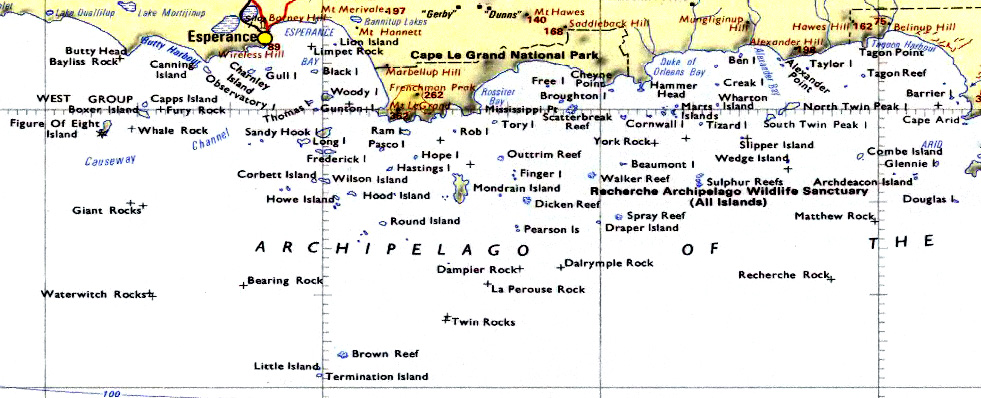
Region of survey area – Esperance to Cape Arid
Interestingly d'Entrecasteaux used the charts of Nuyts who sailed the route in 1627. Flinders in the Investigator also examined this Archipelago in 1802 and Lucky Bay was named when he was lucky enough to find fresh water there.
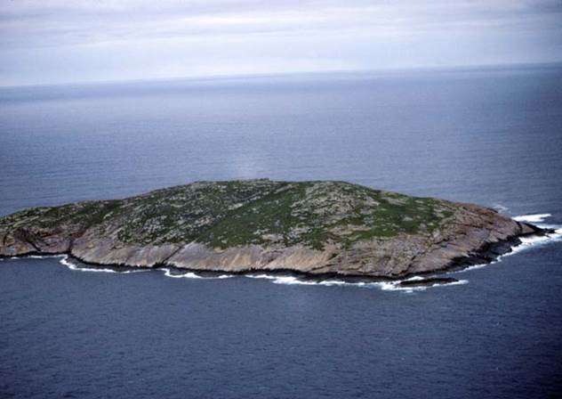
Many of the islands show this history in that they have two and sometimes three names; Kermedec Island also bears the name Archdeacon and Wedge. Hopefully, when the mapping is completed the historical names will take precedence so the map reflects the history. I note the following differences in names between the 1980, 1:1 000 000 scale map and the 2000, 1:250 000 scale map: Wedge > Kermadec, Archdeacon > Helby, Round > MacKenzie, Combe > Westal.
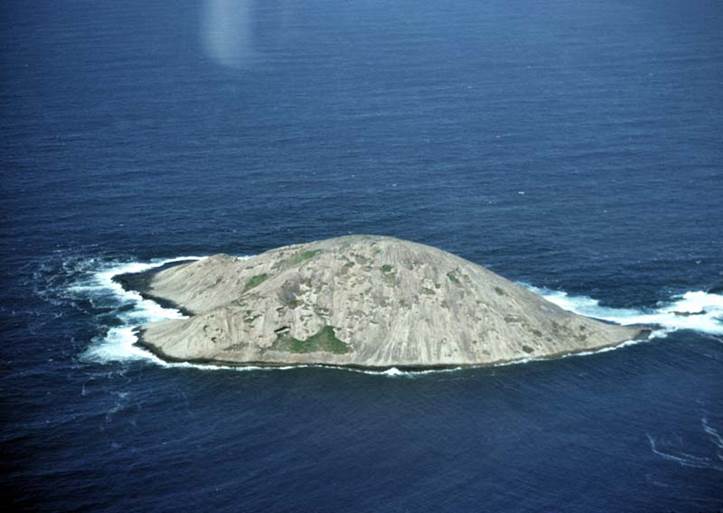
Wedge
and Round Islands
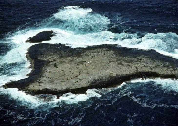
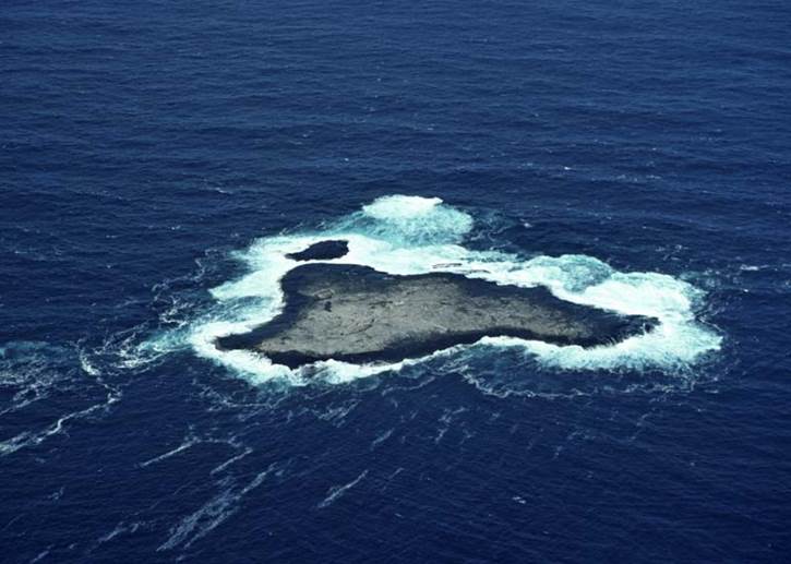
The islands are wind swept, totally inhospitable lumps of granite rising from the sea bed. Some of the larger have a weed like vegetation cover but only Mondrain itself has a tangle of stunted ti-tree. Most have no landing site for a boat and even on a relatively still day the swell makes any boat landing hazardous.
The only animal life was fur seals who seemed to have little trouble in transferring from their watery home to the land. There was little bird life. Although death adders were rumoured to inhabit some of the islands none were seen. The only reptiles were lizards of varying sizes. On Tizard Island the mosquitoes were very large and ate us alive.
I visited Helby and Wedge Islands that Aerodist had occupied in the early 70s and found the station and reference marks in good condition minus white paint. It was surprising as we had the feeling that the weathering effect of wind and water in this part of the world may have destroyed the original marks. In 1973, while on Laser Profiling operations, I visited Alexander Hill trig; I revisited this point too.
Leaving
Tizard Island
The Archipelago is a mixture of islands, rocks and reefs. So as to plot the positions of those features that were visible, horizontal and vertical control was required to orient individual photogrammetric models.
WA Lands had doppler positions on six of the islands while the Navy had fixes on four of the larger islands and several of the isolated rocks. Even ASO had surveyed the two lighthouses (un-manned and one recently converted to solar power) on Gull and Figure of Eight Islands off Esperance. Natmap therefore upgraded this control as well as extended it.
Our
pilot and chopper
Using Magnavox 1502 in the translocation mode ie, 2 on already fixed control and 3 roving, fixes on the outer islands were obtained. While they were running inshore islands were surveyed using Geodimeter and theodolite. The positions of isolated features, which were unable to be occupied, were fixed using the Miniranger. While hovering in the helicopter over the feature the Miniranger simultaneously measured to two known points thus fixing the position.
Using these methods some 15 control points were established, several isolated rocks positioned and for a number of points height only or improved height was obtained.
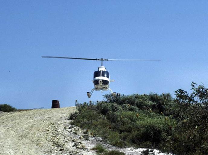
Transport was by helicopter, a Bell 206 Jetranger, which enabled two men with their equipment to be positioned and also provided a spot photography, and Miniranger platform.
The survey was an interesting experience using the technology of the eighties in the most difficult circumstances but with the survey of the Barrier Reef, around the Montebello Islands, of the eastern group of the Recherche and the Investigator Group fading into history the Mondrain Island survey was the last of the Island Surveys and unfortunately joins the list headed "The End Of" in the Topographic (Dandenong) Office.