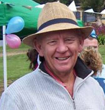
Carl McMaster
National Mapping 1962-1993
Carl was born in Wonthaggi in March 1941 on either the 15th according to his birth certificate, or the 25th according to his mother who was the more reliable authority. Carl’s mother Doris Johnson was a Wonthaggi girl whose father had migrated from Sweden via Kiel in Germany with his parents in the late 1800s. Doris’s mother was the daughter of a Chinese immigrant whose family settled in Buchan and an Englishwoman from Bairnsdale. The Johnson family owned cafes in Wonthaggi and Inverloch and a farm at Cape Paterson. Doris married Ken McMaster from Korumburra whose family descended from a Scotsman who was a former soldier in the British army, and an Englishwoman. Ken’s forebears arrived in Tasmania in the 1850s but soon after moved to the Victorian goldfields. Ken’s father was an engine driver for the Victorian Railways who was based in Korumburra. Ken was a builder and the family settled in Leongatha where Carl was the eldest of five children.
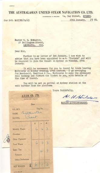
Carl completed High School in 1957 and after briefly trying life as a Deck Cadet on the MV Corinda plying the Australian coast, he was articled to Bryan Hill a Land Surveyor setting up his practice in Dandenong after returning from the Lands Department in Fiji. Five pounds went on board out of his wages of five pounds fifteen shillings with a major expense the train travel to the RMIT on two nights a week. Carl along with many of his classmates struggled to stay awake during the four hour sessions, except during the entertaining lectures of James Love, Head of the Surveying Department. While Melbourne University had a surveying degree course, the Surveyor’s Boards in the various States and New Zealand set reciprocal examinations leading to a Licence to practice, after completing four years of Articles. Bryan Hill’s practice (later Hill and Dawson) was mainly concerned with rural and urban subdivisions ranging across the Dandenongs, west Gippsland and the Mornington Peninsula.
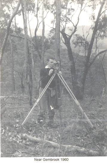
1961/62 saw a minor recession and Carl’s salary of fourteen pounds was difficult for Hill and Dawson to pay. Following a tip in early 1962 from Ted Dugdale a fellow RMIT student, who was a draughtsman at National Mapping in the Rialto building, Carl was interviewed by Supervising Surveyor Joe Lines who determined that he was sufficiently worldly to begin as a Technical Assistant. Carl had a short stint in the office in a section headed by Ed Laos which included Linda Mottus and Kevin Crane. As Carl remembers it, other draughting section leaders were Fred Adamec, Bob Robinson, John Jenkins, Alan Thomson (PNG) and Tom Gale (Antarctic). Byrne Goodrick was Chief Draughtsman and Dave Hocking was his deputy.
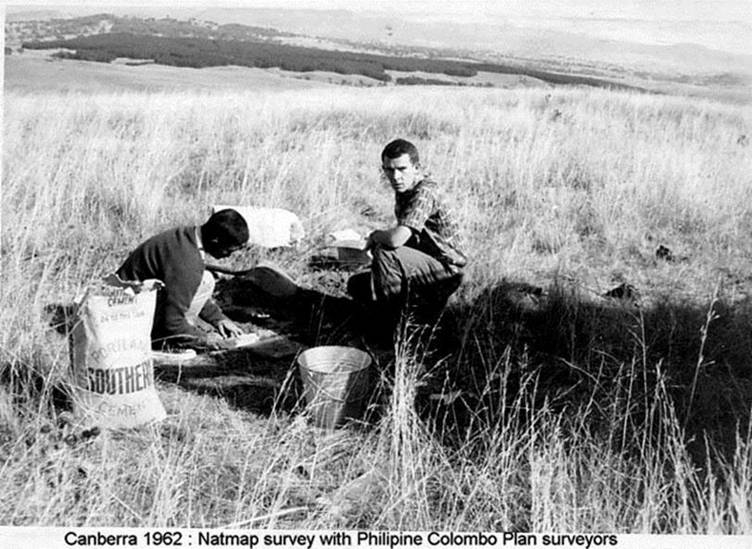
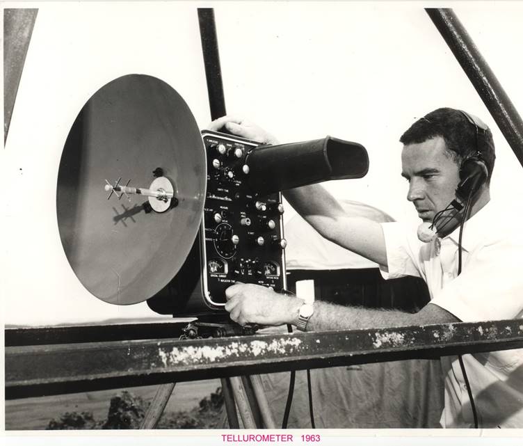
Later in the year Carl and two Colombo Plan surveyors from the Philippines established ground control around Canberra using the new model Tellurometer (MRA2). Klaus Leppert was in charge and used a Natmap Willys 4-wheel drive while Carl had an International AB model truck from the Melbourne office. The Hostel on the hill where Parliament House now stands was home for Carl and the Philippinos and several hundred workers who were excavating Lake Burley Griffin.
In the early 1960s mapping of the Bowen and Surat Basins in Queensland was a priority. Late in 1962 Carl flew to Rockhampton and on by overnight train to Clermont to join Frank Leahy’s party who were extending the 2nd order tellurometer traverse from west of Mackay to Springsure. The field party was aware of the area’s extensive coal deposits as seams were sometimes exposed in creek crossings. However, the only coal mine at this time was at Blair Athol near Clermont. This traverse continued the following year and Carl recalls the arduous task of carrying beaconing materials with Terry Douglas and Jacques de Stephanie to the summit of Mt William in the Eungella Ranges.
In 1961 the airborne Aerodist distance measuring system developed in South Africa, was purchased by National Mapping to rapidly intensify ground control for the 1:100,000 scale mapping program. After extensive trialling near Melbourne, Aerodist with the master equipment mounted in a Bell 47 J helicopter chartered from Ansett-ANA was deployed in the Eidsvold/Gayndah area in 1963 with Len Turner as party leader. These surveys continued in 1964 in central Queensland. Carl operated an Aerodist remote at ground stations during this work. He also recalls locating and clearing lines from trig stations established by Army Surveyors during WW2 along the ranges of the Queensland coast to enable the Aerodist network to be tied to the geodetic network.
During this period Carl embarrassed his boss Ted Seton, when they were on a levelling survey connecting the new ground marks to benchmarks. While backing the Inter into the kerb he felled a post and dropped the veranda of the corner pub in Collinsville, to the amusement of the bar patrons.
As the helicopter‘s range and cabin space was limited, from 1965 an Aero Commander aircraft (VH-EXY) was chartered from Executive Air Services out of Essendon. During the next several field seasons, Aerodist was extended into New South Wales, northern Victoria and across Queensland, including to the Islands and sand cays of the Great Barrier Reef from Fraser Island to the Torres Strait. These surveys were supported by several Navy ships including HMAS Paluma and by chartered fishing vessels. Carl vividly remembers Syd Kirkby directing him with Kevin Moody as booker to make his first flight operating the master equipment out of Mackay. These surveys entailed flying at altitudes ranging from 8000 feet to below 300 feet above the sea to receive usable data from the ground stations.
Aerodist generated a huge amount of data on strip charts which had to be reduced to distance measurements and tied to the geodetic network. Frank Leahy developed the algorithms and wrote the software for the computations. In the office, Carl became responsible for the team calculating the Aerodist distances and the coordinates of the ground stations. The Varycord program developed by Tony Bomford at Natmap Canberra, adjusted the network of braced quadrilaterals and fitted it to the geodetic framework. Then state of the art paper tape and later punched card input was used initially at Control Data Corporation’s offices in St Kilda and later at the CSIRO David Rivett centre at Monash University and in East Melbourne to compute the results.
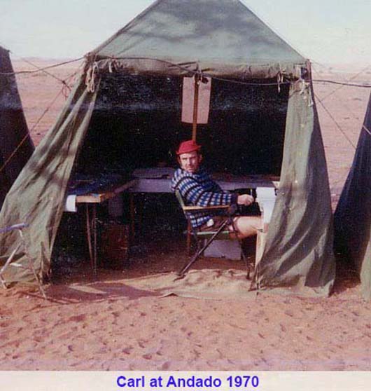
Carl also continued to work in the field as an Aerodist operator and in ground marking parties as Aerodist was extended into the Northern Territory. While based at an out-station of Wave Hill in 1966 he saw the beginning of the indigenous land rights movement as the stockmen went on strike for better pay and conditions. In the 1970s the Aerodist party worked from the north of Western Australia south to the Nullarbor where Carl honed his golfing skills across rocks and sand on holes devised by Roy Turner.
In the summer of 1975/76, Carl was a member of John Manning’s Antarctic team which traversed from Mt King west of Mawson to the Russian base at Molodeznaya. He remembers a day’s preparatory rappelling training in Australia with Bruce O’Connor at his Commando Unit in Williamstown, and arriving afterwards in the Unit’s mess to learn that Gough Whitlam had been deposed as Prime Minister.
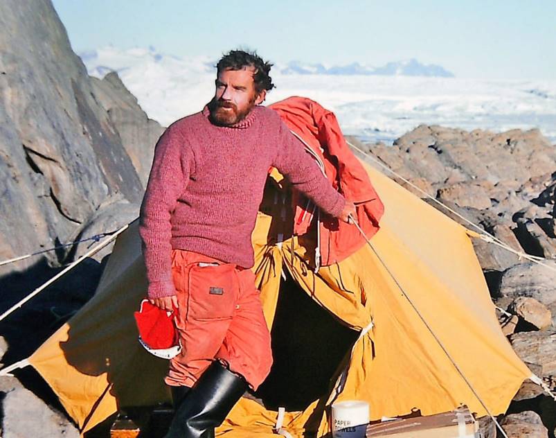
Antarctica - Enderby Land 1975/76
Carl had completed several Fortran programming courses and wrote Natmap versions of the RASC developed software which automatically generated map sheet grids and graticules on the large flatbed plotter at the Ammunition Factory in Maribyrnong. Dave Hocking initiated this work and Carl and Ted Caspers were introduced to the software over a couple of weeks at Army Survey in Bendigo. He recalls Stuart Peacock, an early Natmap Computer Systems Officer being appalled at the rudimentary programs which were too entrenched to rewrite.
Carl married Trish Bannigan who was the daughter of a Broken Hill miner in 1970 in Melbourne. Fortunately, field trips were now normally around six weeks long compared to the 1960s when field staff were away for up to nine months.
Trish quickly realised that Carl had never completed his Surveyors Board examinations and urged him do so. With the help of Norm Edwards an ex-Natmapper and Greg Ellis both lecturing at the RMIT he finally got his License and having progressed through the ranks to a Senior Technical Officer joined the professional Surveyor ranks. Ed Burke booked for Carl’s astronomy practical examination undertaken in the MCG carpark (now long gone) and he spent a harrowing night at home in Lilydale confirming that his observations were accurate before fronting up next morning at Melbourne University to make the calculations under the watchful eye of the examiner, Professor Brian Murphy.
In 1977, National Mapping moved to Ellery House in Dandenong where Carl continued occasional field trips including map accuracy and field completion surveys. He headed the section performing photogrammetric block adjustments using the MODBLOCK suite of programs developed by Claude King. This team also flew aerial photography using a chartered aircraft and in 1977 acquired photography for defining the coastline in the north of Western Australia. He confesses that the calculation of the necessary tidal information was largely the province of Bill Stuchbery and was a mystery to him.
In the early 1980s, Natmap’s airborne laser terrain profiler developed by WRE had reached the end of its useful life and Supervising Surveyor Bobroff continued to talk about a replacement. The topographic group took up the challenge and Paul Wise who had been studying in the Netherlands detoured home via the USA to view an operating YAG laser profiling system. This system was later purchased and formed the basis of a new Natmap terrain profiler. Carl’s research determined there were no Australian safety standards for the laser which was a worry. However, with John Ely’s expertise and his electronic lab people the laser was integrated with a 70mm strip camera and other peripheral equipment and with software written by Ian Graham the PRAM system was built (later called LAPS for Laser Airborne Profiling System). It was successfully trialled in Natmap’s Cessna 421C aircraft in 1985, flying out of Townsville with Harry Baker, Ed Burke, Ian Graham, John Ely and Carl and in later years was flown in Australia and on contract in Indonesia.
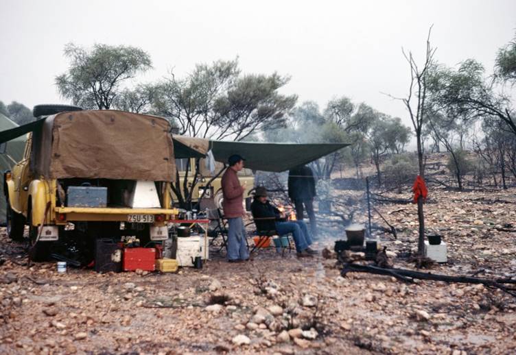
Carl at a field camp in the late 1970s
Carl also worked as the surveyor in a Joint Management Team (JMT) oversighting a draughting group. JMT’s were devised to resolve the conflict between the professional and non-professional staff and he suspects that JMT’s were unique to National Mapping in Melbourne.
In mid-1985 Carl was “temporarily” posted to Canberra to act as the Executive Officer for the Director of National Mapping, Con Veenstra. This tenure extended until the end of the year but he was recalled to Canberra in early 1986. Meanwhile Trish had their school age children Kirstyn and Jarrett to look after and was oversighting the building of their new home in Melbourne.
In 1985 the Australian Landsat Station (ALS) founded in 1979 had been transferred from the Department of Science to National Mapping. Con Veenstra perceived that a deputy was needed to assist Don Gray who was the first Director of the ALS. Carl had been a Melbourne based representative of the remote sensing group which had been monitoring the potential of satellite imagery to assist in topographic mapping. He and Trish needed to have some certainty before moving the family from Melbourne to Canberra. After some difficulties in opening up the position from an Engineer classification to include surveyors, Carl applied and was appointed as the Deputy Director, ALS in 1986 and the McMaster family moved to Canberra.
The ALS was being upgraded to receive and process data from the new French SPOT satellites and the new generation of Landsat satellites at a cost of around $15 million dollars. Carl pays tribute to the support of the members of the Australian Liaison Committee on Remote Sensing by Satellite (ALCORSS) especially Dr Ken McCracken (CSIRO) and Professor John Richards (University of NSW) during this upgrade. Credit is also due to the ACRES staff in Canberra and Alice Springs who managed to surmount the considerable technical hurdles of the upgrade. The ALS was renamed the Australian Centre for Remote Sensing (ACRES) and was the primary agency providing satellite imagery directly and through accredited Distributors to the government and private sectors.
Later in the 1980s, a joint effort between ACRES, CSIRO, Meteorological Bureau and the Antarctic Division established a satellite receiving station (TERSS) outside Hobart which extended the range of the ACRES Alice Springs ground station towards Antarctica and over New Zealand.
As well as the Landsat and Spot reception agreements, contracts were negotiated with the Japanese agency NASDA, to receive data from Japan’s MOS and JERS satellites and the European Space Agency’s ERS radar satellite. Carl represented ACRES/AUSLIG’s (formerly National Mapping), interests with these organisations and was also the Department’s representative at the Australian Space Board meetings. He also represented Australia in the United Nations sponsored meetings and interacted with Asian remote sensing agency leaders in the region. Don Gray retired in 1989 and Carl was promoted to the Manager’s position and was ably supported until his retirement by the indefatigable Paul Wise.
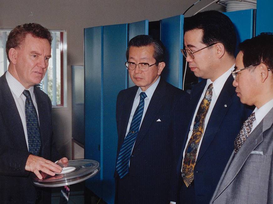
NASDA (Japan’s Space Agency) officials at ACRES
A major achievement by ACRES was the preservation of their Landsat imagery archived from the early 1980s. Carl recalls Robin Buckley the then Chief Engineer arriving home from a trip to North America with a brochure describing the new Canadian built CREO Optical Tape Recording (OTR) system which had the potential to archive the many thousands of high density digital tapes (HDDT’s) stored in a large airconditioned room at ACRES onto far fewer optical tapes. The HDDT tapes were degrading in quality despite recycling them using an expensive manual tape rewinding regime. In 1991, ACRES purchased the first of three OTR’s costing around $400,000 each. An OTR tape stored one Terabyte of data. In 2013 an equivalent storage device costs less than $1,000. The technology was unique and the technical challenges to transcribe from magnetic to optical tape were significant. The professional ACRES engineers headed by Robert Denize, and his computer staff designed and implemented the system. When transcribed the ACRES imagery magnetic tape archive on HDDT was reduced to 50 optical tapes enabling huge savings in storage costs and the generation of an accurate catalogue of the imagery.
This archive has contributed to the production of 19 epochs from 1972 to 2010 of Landsat imagery covering Australia. It is used by the Department of Climate Change and Energy Efficiency (formerly the Australian Greenhouse Office) in their National Carbon Accounting System to monitor land clearing and revegetation. The preservation of the ACRES archive via optical tape also enabled data from the European ERS Synthetic Aperture Radar (SAR) satellites to be retained. These data have recently been made available as part of the AuScope Australian Geophysical Observing System (AGOS) project and has been funded by the Australian Government through its Education Investment Fund (EIF) to monitor the physical state of the Australian continent.
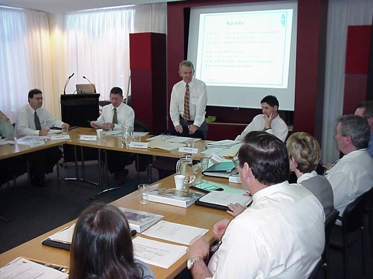
SIS Distributors Meeting – Daniel Jaksa, Damian Carroll, Carl, James Prior, Mike Linney and Brian Button
ACRES had accredited data distributors throughout Australia and Arman Larmer Surveys in PNG. Indica Dharma in Jakarta was the ACRES data distributor in Indonesia as the ACRES Alice Springs antenna had a footprint over eastern Indonesia. Carl had the opportunity to explain satellite imagery at a small meeting of Australian and Indonesian representatives of various science disciplines in Jakarta. Minister Habibie the Indonesian Minister for Science and Technology attended and expressed enthusiasm for satellite imagery and invited cooperation between Australia and Indonesia. The Australian Deputy Ambassador who was in attendance was amazed as apparently Minister Habibie (later President of Indonesia) had not previously enjoyed a good relationship with Australia. Carl was asked to provide a written report overnight to the Embassy “on what was all that about”. ACRES staff subsequently provided technical assistance to the Indonesian government’s ground station outside Jakarta. Carl noted that as President, Dr Habibie in the late 1990s visited Australia and ACRES.
In December 1993 Carl resigned from ACRES after 32 years of service with the Commonwealth to head up the Spot Image subsidiary, Spot Imaging Services (SIS) in Sydney. SIS represented its parent company in Australia and the Pacific, marketing satellite imagery directly and through distributors. A noteworthy project was arranging the acquisition and sale of Spot imagery over New Zealand received at the Hobart ground station.
Carl retired in 2001 and he and Trish enjoy life on the Sunshine Coast playing golf and travelling.
Carl completed an oral history for the Australian National Library which may be listened to via this link and his permission to publish his profile is appreciated.
Supplied October 2015