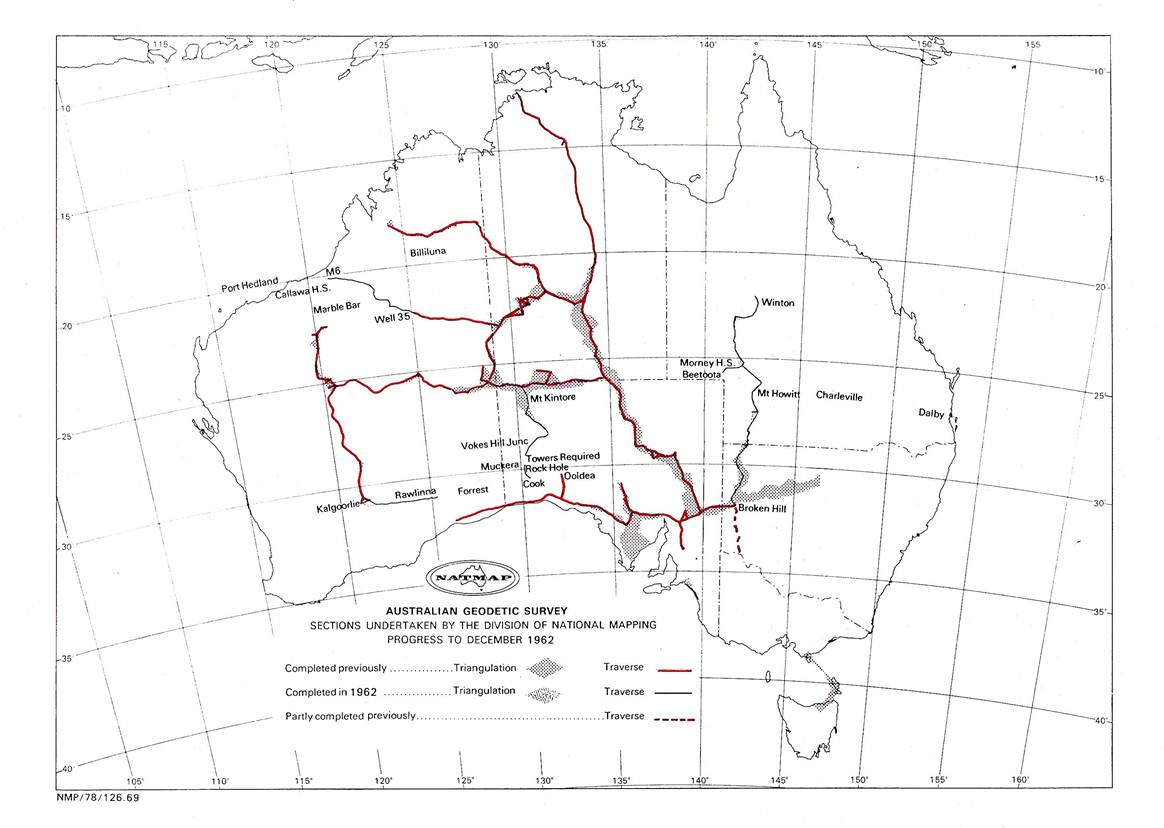
1962 Program
In planning the 1962 program it was decided that each party would have a Tellurometer so that the traverse could be completed by one party in the one movement through the area. The program drawn up was:
(i) Beaconing, Theodolite/Tellurometer traverse Mt Kintore – Vokes(*) Hill Junction, SA
Reconnaissance, beaconing, Theodolite/Tellurometer traverse
Vokes(*) Hill Junction - Cook, SA
Reconnaissance, station marking, tower erecting, Cook - Ooldea, SA
O.J. Bobroff would complete these tasks.
(ii) Winton - Mt Howitt, Qld. Finalise beaconing, Theodolite/Tellurometer traverse, simultaneous reciprocal azimuths.
Mt Howitt, Qld - Broken Hill, NSW. Tellurometer measurements, simultaneous reciprocal azimuths.
Morney Downs - Beetoota, Qld. Theodolite/Tellurometer traverse, simultaneous reciprocal azimuths.
J.W. Witzand would complete these tasks.
(iii) Kalgoorlie - Rawlinna, WA Theodolite/Tellurometer traverse with simultaneous reciprocal azimuths (including towers).
Rawlinna - Forrest, WA Reconnaissance, marking and tower erecting.
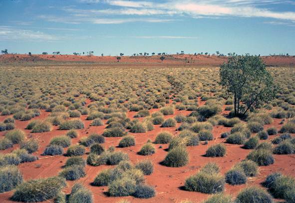
Callawa - Well 35, Canning Stock Route, WA Reconnaissance, Theodolite/ Tellurometer traverse, station marking, simultaneous reciprocal azimuths.
R.A. Ford would complete these tasks.
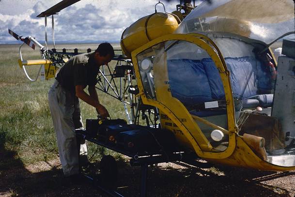
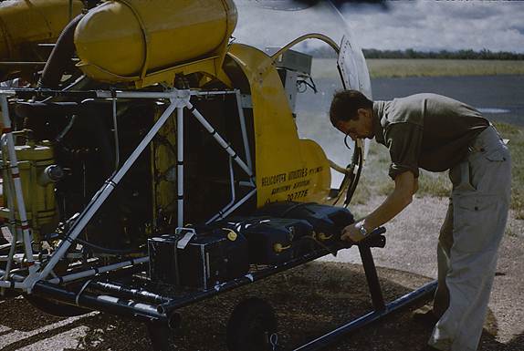
(iv) Reconnaissance by helicopter, Dalby - Charleville - Mt Howitt, and Morney Downs - Beetoota, Queensland.
Astronomical observations, Woomera area SA
A.G. Bomford would complete these tasks.
The following staff changes influenced the organising of the survey parties required for the above program:
R. Maruff and J. Allen were selected to attend the Army School of Military Survey - Basic Survey Course, and would not be available for field duty for the first half of the year.
A newly graduated Surveyor Class 1, I. Johnson and a new Field Assistant (Survey) J. Pearson, joined the Geodetic Survey Branch. Later in the year a new Surveyor Class 1, K. Richardson also joined the staff but stayed only a few months.
Astronomical observations Woomera area
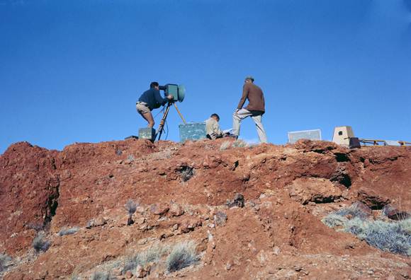
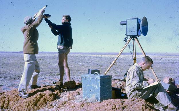
Early in 1962 A.G. Bomford held a short training course in Canberra to teach the Almucantar observation for longitude and the circum-meridian observation for latitude using the Wild T3 theodolite and split-hand stopwatch.
H. Couchman, G.J. Cruickshanks, I. Cameron and R. Scott attended; they then proceeded on a field program of astronomical fixes in the Woomera area of SA See technical Report No. 3, “The Woomera Geoid Surveys, 1962-63” by A.G. Bomford - December 1963.
Mt Kintore - Cook, SA Theodolite/Tellurometer Traverse
O.J. Bobroff was party leader, he would be Master Tellurometer operator and do simultaneous reciprocal vertical angles in conjunction with the Remote operator. He would also train R. Goldsworthy as Master operator during the season; D. Hutton would be the theodolite observer and Remote Tellurometer operator.
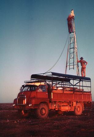
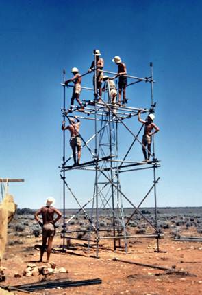
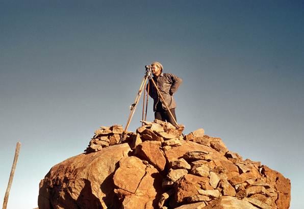
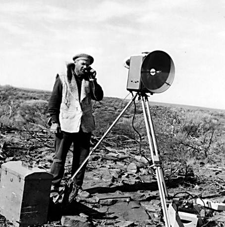
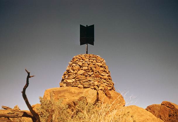
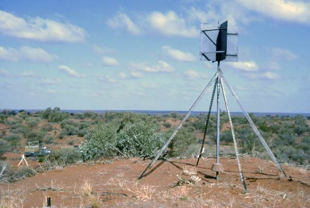
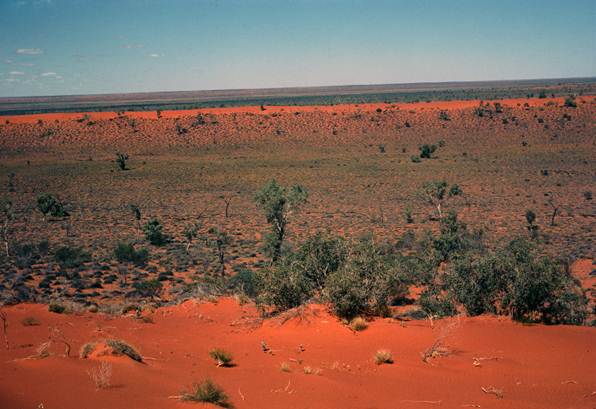
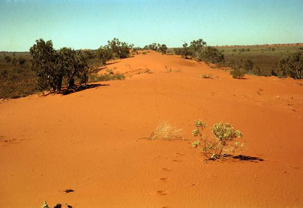
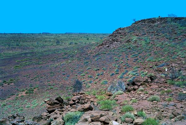
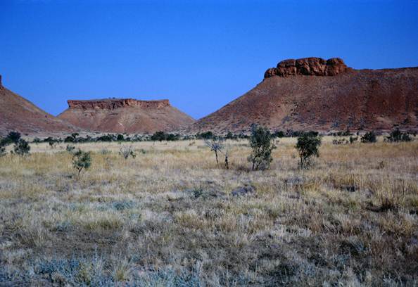
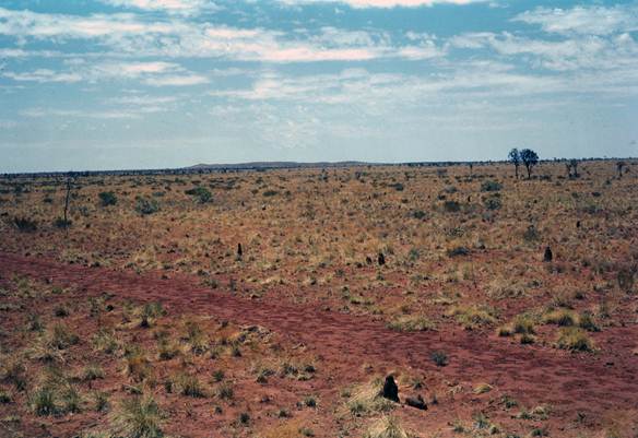
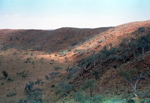
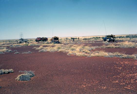
The party left Melbourne in late April calling at WRE Adelaide en route, picking up three field assistants and vehicles. Beaconing, observing and measuring commenced at Mt Whinham - Mt Kintore, the northern end of the traverse. These first hills were all solid climbs but had been beaconed. From Mt Kintore cairns had to be built as far south as Cheeseman Peak but from then on most were on sandridges where a steel pole with vanes was stayed with four ten feet lengths of “Unimet”. Once the sandridge country was reached the traverse generally followed the track graded by L. Beadell of WRE. Figure 1 shows the observer reading in the reference marks at Mt Tietkens, SA.
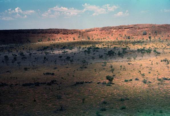
In a flat mallee covered area about 100 miles north of Cook it was found about three towers would be necessary. Emerging from the sandridges onto the stony Nullarbor Plain some sixty miles north of Cook, it became evident that towers would be needed all the way.
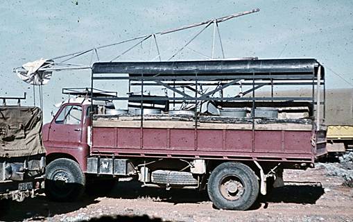
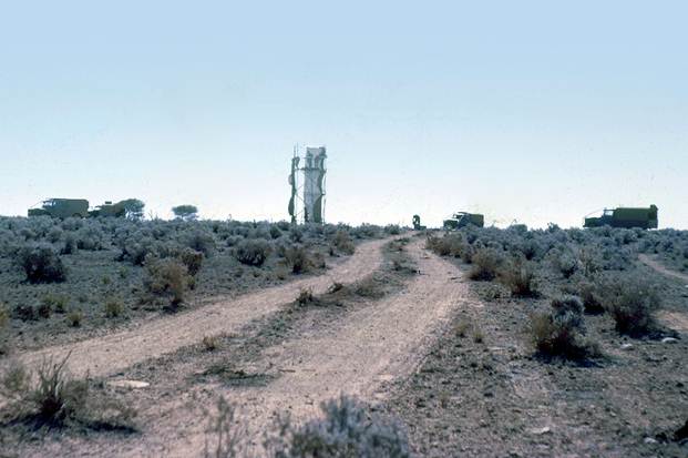
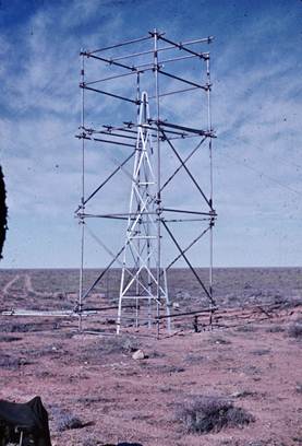
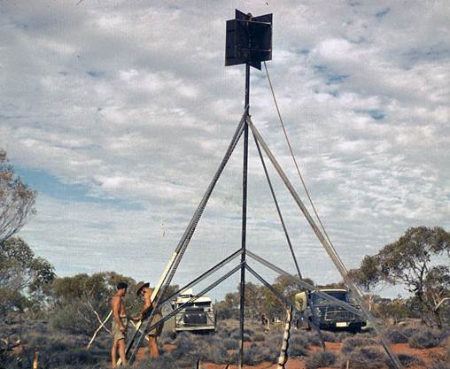
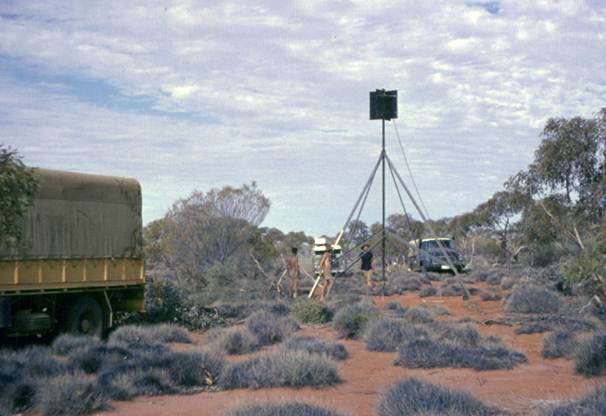
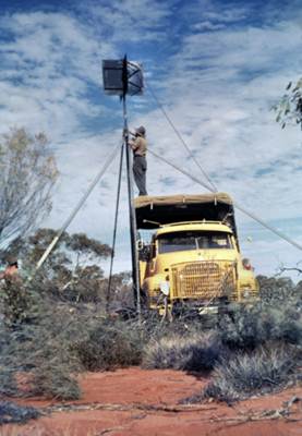
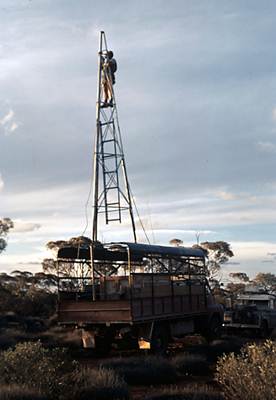
A twenty foot tower was rigged on the back of a Bedford truck so that it could be left assembled in a horizontal position, but could be immediately pushed erect for reconnaissance purposes. The use of this reconnaissance tower greatly simplified the selection of tower sites over this last sixty miles and also between Cook and Ooldea along the Transcontinental Railway Line. Figure 2 shows the twenty foot reconnaissance tower on the Bedford truck.
In the desert country a native well, Waldana was cleared out, timbered and made usable to help solve the water problem; during most of this survey the weather was cold and windy therefore water was not the huge problem it had been further north in the previous year.
Muckera Rock Holes - Cook SA Tower Traverse
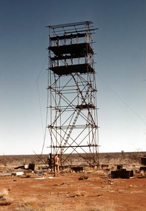
R.A. Ford with the tower equipment and observers joined O.J. Bobroff, in late October, to complete this last section of the Kintore - Cook traverse where about seven towers were needed.
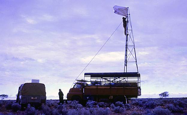
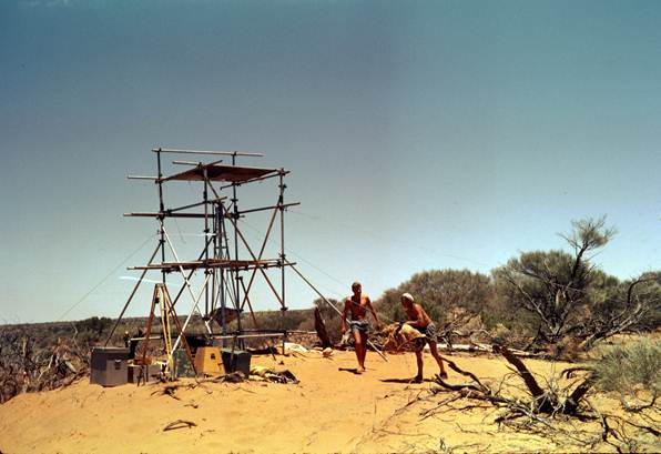
There had been heavy rain in the Cook area about ten days earlier but the terrain was now drying out. Work on erecting the towers started on 29 October. Owing to the difficulties experienced when working from towers in the strong winds on the Nullarbor Plain earlier in the year it had been recommended that only twenty foot towers be used and the reconnaissance had been done with this in mind. However because of difficult terrain it was necessary that the most northerly tower of this section be a thirty foot tower.
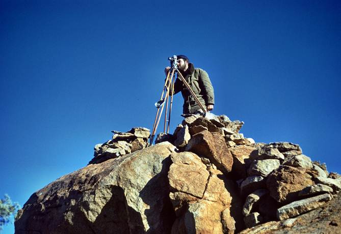
Figure 1: Reading in the reference marks at Mt Tietkens, SA - R.W. (Bob) Goldsworthy.
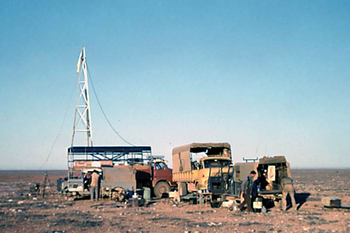
Figure 2: Twenty foot tower on canopy frame of Bedford truck and erect for reconnaissance – eye level about 30 feet.
Four observers were available, three from the tower party plus D. Hutton from O.J. Bobroff's party. Also from that party, R. Goldsworthy could assist with the Tellurometer measuring. Observing commenced in hot and windy conditions; on two of the stations because of gale force winds on the second night, observations from the towers were not possible. A set up was made on the ground and the observing screen erected; lights on the distant towers could be seen after dark because of the lift of refraction and observations to these were completed. When the eccentric corrections were applied, the mean of the observations from the tower agreed well with the mean of those from the ground station.
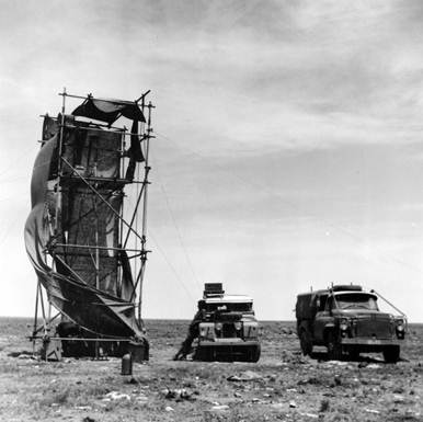
At NM/E/185 the site of the thirty foot tower, some observations including a simultaneous reciprocal azimuth were completed with difficulty because of the wind, even though the tower was shielded with hessian. The next day the wind had dropped a lot; in an effort to ensure sufficient stability to complete the thirty foot tower observations that night, the scaffolding was completely sheathed in hessian.
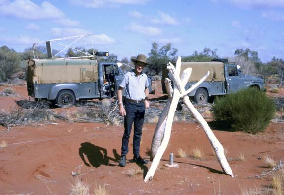
R. Scott commenced the observing in hot but only slightly windy conditions. However a violent cold wind and dust storm blew in from the west; the force of the wind on the large area of hessian proved too much for the guys, breaking one and pulling the steel picket from the ground on the other. This caused the scaffolding to collapse against the tower which in turn was toppled over. The booker got down alright but R. Scott, who tried to pack up the theodolite, came down with the tower. He received concussion; O.J. Bobroff quickly organised a vehicle and took him to hospital in Cook. It was found he needed stitches to cuts in his forehead and under his arm and his shoulder was also bruised. He remained in hospital for about a week. Figure 3, the collapsed tower and scaffolding.
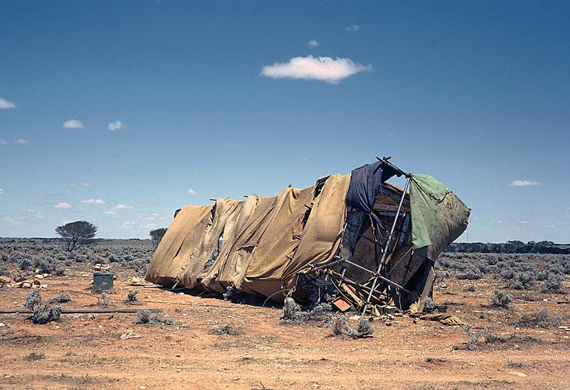
Figure 3: Collapsed tower and scaffolding.
To complete the observations at NM/F/185 a twenty foot tower was now erected and a ten foot tower on NM/F/184. This combination was just good enough to complete the observations. The remainder of the tower observations were completed by 18 November.
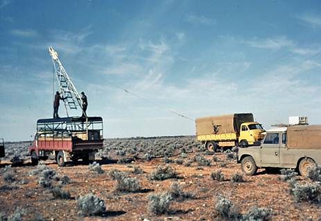
During the final stage of the work H.A. Johnson arrived to discuss the difficulties created by constant windy conditions, particularly as they applied to the huge amount of tower work yet to be completed on the open Nullarbor Plain. A demonstration was arranged from a station where aided by the lift of refraction lights on both distant stations could be seen from ground level, one observer working from the tower and one from an eccentric station at ground level. The results from both positions agreed quite well, the means were within one second and both had a similar fairly large spread. The targets as viewed from the ground station were not as good however, the wind causing the tower to vibrate cancelled out this advantage. On the other hand the observer on the ground could work under all conditions and at normal speed. This then seemed a possible method of traversing in the constantly windy conditions; do the Tellurometer measuring and simultaneous reciprocal vertical angles from the tower and the horizontal angles and simultaneous reciprocal azimuths from ground level inside the shelter of an observing screen when the lift of refraction brought them into view in the late afternoon.
The observing party left Cook for Melbourne on 19 November in bad weather conditions; the diary of that day reads “Worst dust storm I have ever known.”
O.J. Bobroff and his party completed the erection of the towers between Cook and Ooldea before returning to Melbourne a few weeks later. Overall during the season his party beaconed measured and observed 27 stations, including the tower section; distance Mt Kintore - Cook 360 miles.
Kalgoorlie - Rawlinna WA Traverse
The field party was organised with R.A. Ford as party leader and observer, he would train J. Pearson who would be Master Tellurometer operator; R. Scott would be the other observer, he would train G. Humphries who would be Remote Tellurometer operator. A.S. Colvin now a Technical Officer Grade 1 would be with the party as survey computer. F. Combe would do reconnaissance and tower erecting eastward from Rawlinna to Forrest. There would be three WRE men and vehicles with the field party.
All arrived at Rawlinna on 6 April and immediately two observing/Tellurometer parties and one reconnaissance/tower erecting party were formed. The observing parties started westward to commence measuring and observing on the hills near Kalgoorlie. R. Ford stayed with F. Combe to help him get the reconnaissance started and see that the towers were sited well clear of the railway line. Once three tower sites had been selected the party leader left to join the observing party.
As all members of the observing party were inexperienced with the Tellurometer, measuring with it had to be learnt the hard way, and early trouble with the new transistorised power pack and the instrument itself didn't make matters any easier but as they became more confident the speed of the measuring improved. However, for observing, visibility was reasonable and soon both J. Pearson and G. Humphries were able to take a share in the horizontal and vertical angular work and also the observing of the simultaneous reciprocal azimuths.
Within three weeks the work on the hills had been completed so that tower erecting and scaffold building could commence. These tower sites were certainly uncomfortably close to the railway line so work was pushed ahead to get this section finished as soon as possible and the towers down for good. It took four weeks to complete all the work in this difficult section, and another fortnight to complete the next section where towers were more satisfactorily sited. This brought the party to Rawlinna by 9 June in cold and wet conditions.
Luckily the weather was not too windy while observing from the thirty foot towers sited close to the railway; in this area the high mallee gave some shelter. When the observers got to the open plain near Naretha difficulty with the wind was constantly experienced and sometimes it was impossible to work. The hessian screens made the scaffolding unsafe and without them the wind had too much influence on the tower for any satisfactory standard of observing.
Simultaneous reciprocal azimuths were observed along every fourth line and computations were kept up to assess the standard of the work so that any extra observations could immediately be done. Having A. Colvin with the field party to assist in checking and finalising field books, computing geographic coordinates and the simultaneous reciprocal azimuths made this task much easier than it was on the previous year's tower traverse.
With the traverse completed from Kalgoorlie to Rawlinna and the reconnaissance and tower erecting complete to Forrest the party was reasonably satisfied and was very pleased to be going north to find some warmer weather - all except A. Colvin and J. Carlisle who were to return to Melbourne. F. Combe also took the Bedford to Melbourne to collect beaconing material for the northern work.
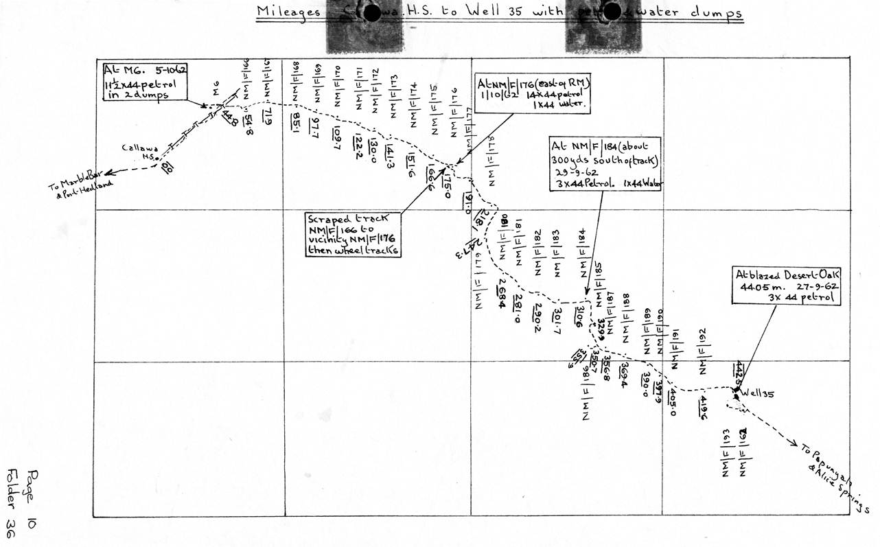
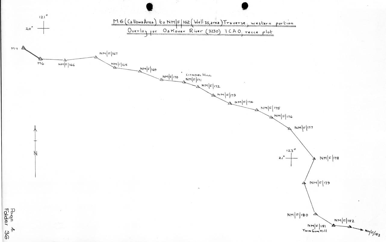
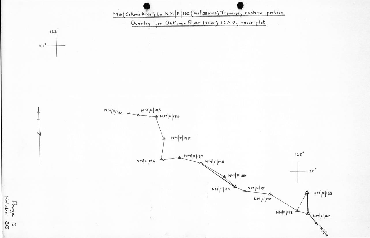
Callawa to Well 35 Traverse
The Bedford containing the scaffolding was sent to Perth for storage until the spring. The Tellurometers were also taken for maintenance and adjustment.
The rest of the field party drove from Kalgoorlie to Marble Bar. R. Ford and J. Pearson went ahead some days earlier to commence the reconnaissance. Before leaving Melbourne a possible route had been selected on the ICAO 1:1 000 000 scale maps and then checked on the 1:250 000 scale photomosaics. This route would avoid crossing large numbers of sandridges. The individual air photos covering the route were brought so that the track could be plotted accurately and the stations identified.
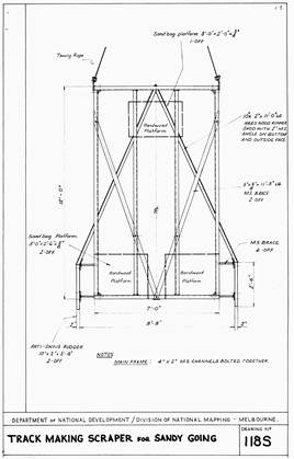
Leaving Marble Bar the reconnaissance party went to Callawa HS then followed the telephone line north east to the WA Lands Department trig station M6. This was selected as the meeting point for the arriving vehicles, they then pushed out in the desert along the route selected on the photomosaic and reconnoitred two stations both on sandridges but were forced to return to M6 as one vehicle was out of action with a broken spring. The field party arrived at M6 at this time, the Bedford was unloaded and went to Marble Bar to bring in a full load of petrol. F. Combe arrived from Melbourne with a Bedford load of beacons, cement and other supplies; these included a track scraper consisting of a rectangular angle iron frame with a “V” shaped prow of heavy red gum plank. This was to clear a track and throw
the debris to each side. The Supervising Surveyor wanted this towed by the Bedford to make it easier for the following vehicles. It was also to scrape a baseline for use in establishing the recovery marks.
The whole party left M6 on 7 July ready to commence their various tasks which were fairly straight forward. R. Ford and J. Pearson would be the forward observing party; they would share the observing including the simultaneous reciprocal azimuths, J. Pearson would be Master Tellurometer operator and R. Ford would control the route of the track and select the traverse stations. R. Scott and G. Humphries would be the other observing and measuring party while F. Combe would have charge of the track making.
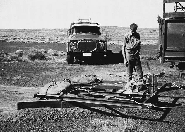
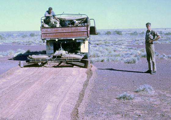
Figure 4: Track scraper with M.J. (Mike) Stevens; this was towed by a Bedford 3½ ton, 4x4 truck.
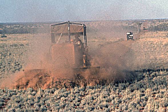
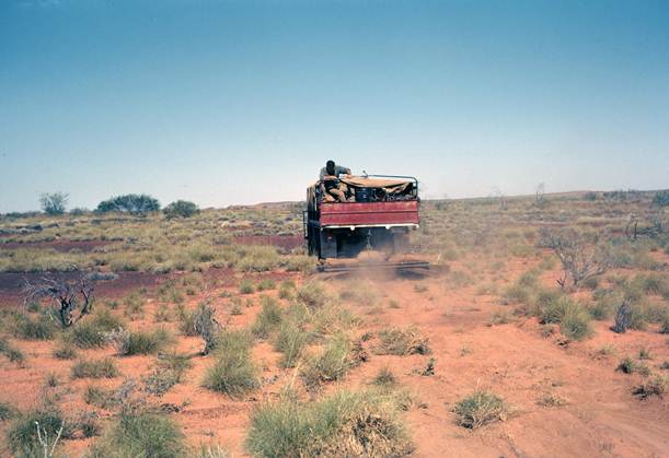
There were plenty of problems with the track scraper; at first the track was too narrow, then too deep on one side, etc. etc; however eventually it began to perform reasonably well and certainly the track it was making was helping the following vehicles, and an easier job of the base lines for the recovery marks which otherwise would have had to be done shovel. Figures 4, 5 and 6. Show the scraper, the track it made and a scraped base line at a recovery mark.
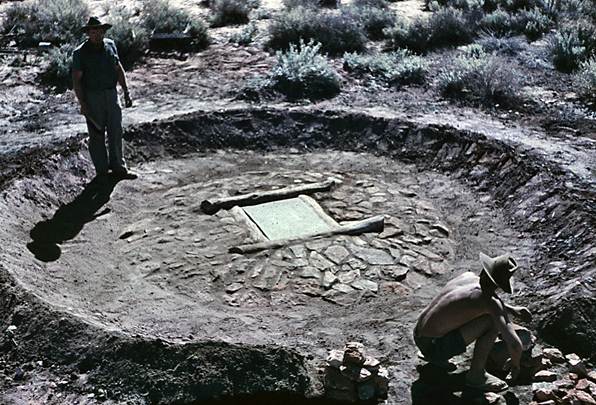
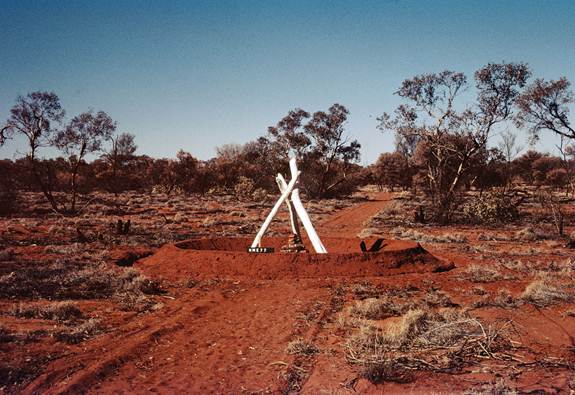
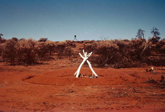
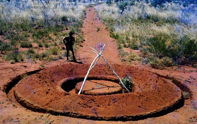
The Recovery Mark procedure is laid down in National Mapping’s Training Manual, Volume 1, 3.5.3. Briefly it consists of establishing a recovery mark in the centre of two 300 foot baselines on the loamy flat about 300 to 400 yards from the station mark on the sandridge. The baseline is measured with a 300 foot invar band; horizontal and vertical angles are read at the Station Mark to Recovery Mark and the two base terminals. In this manner the distance, Station Mark to Recovery Mark, and the difference in height can be calculated from two separate triangles to give a check. Bearings from a distant station are read to the recovery mark and the base terminals. This data is absolutely necessary where beacons are established on sandridges where erosion can completely destroy a station in a few years. Each recovery mark was marked with a heavy white painted bush tripod set over the mark and a 12 foot diameter circular trench 18 inches side and 16 inches deep was dug around the mark. Figure 6 shows a completed recovery mark. Beacons over the station mark on the sandridge were a 12 foot steel pole and vanes stayed with four ten foot lengths of “Unimet”. Tellurometer measurements and observations were done from an eccentric station.
The party had pushed 77 miles from the telephone line into the desert completing six stations when H.A. Johnson arrived. It was decided the most efficient procedure was for him to go ahead and select the stations, passing the data back by radio each morning. The Bedford towing the scraper would follow his wheel tracks, some days behind naturally; this party would erect the beacons and scrape the baselines. The observing/measuring parties would be a few days further behind.
This arrangement held good for only a few hills when disaster struck the Bedford trucks. Reverse gear could not be engaged on the one towing the scraper, and the other, on taking over the towing immediately broke the transfer box drive shaft. Plans had to be changed immediately, the driveable Bedford was sent to Port Hedland for repairs to the gearbox; it took the transfer case of the other Bedford also for repairs. This vehicle was to bring back as much petrol and water as possible, food and mail. J. Allen who had been at the School of Military Survey, Basic Survey Course, arrived in time to come back with the vehicle.
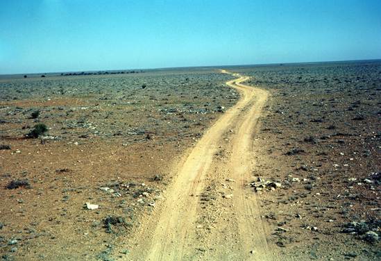
Thus the scraped track ended 130 miles from the telephone line, the route being just wheel tracks from that point to Well 35. These were well defined by the time the traverse was completed.
A leapfrog arrangement was found to be the best system for the observing/measuring parties. This fitted in well with the required two nights observing and two measurements along each line plus simultaneous reciprocal azimuths along each fourth line. On the very few occasions when the mean of each night's horizontal angle observation did not agree within one second, another night's observations were taken. Simultaneous reciprocal vertical angles were also taken along each line.
Progress was steady, a couple more trips were made by the Bedford to Port Hedland for petrol, water, spare parts, food and mail. A well was dug at the 164 mile point; the digging was difficult owing to limestone and there weren't any spare personnel to leave as a digging party. Each time the Bedford passed en route to Port Hedland more digging was done; eventually water was struck at about 10 to 12 feet, the breakthrough only coming after a bit of a nudge with gelignite. The water was very brackish. Unfortunately it was located too late to assist the observing party as the breakthrough came on the Bedford's last trip by which time the observing was complete. However all were able to have a good bath on the way out and it should be useful for those who follow. Figure 7, digging the well.
During August, H.A. Johnson completed the reconnaissance to Well 35 and a junction with O.J. Bobroff's traverse of the previous year. By this time the observing parties were 130 miles behind. R. Ford went forward to join the Senior Surveyor taking petrol and food. At Well 35 plans were made for the last part of the traverse and the junction with O.J. Bobroff's traverse. After discussing alternative routes for a traverse to the north it was decided that a route following the wells of the disused Canning Stock Route was likely to be the most successful as it would avoid the carting of water.
R. Ford collected the reconnaissance notes and returned to the observing party and H.A. Johnson commenced the reconnaissance northward.
The traverse was completed to Well 35 by 24 September; the main hardship on the trip being lack of water as only about one gallon a day per man was available for all purposes. Twenty eight stations were established, thirty-one observed, identified on air photos and the track plotted. The distance was 398 miles from the telephone line near M6 to Well 35; track scraped 130 miles, time eleven weeks.
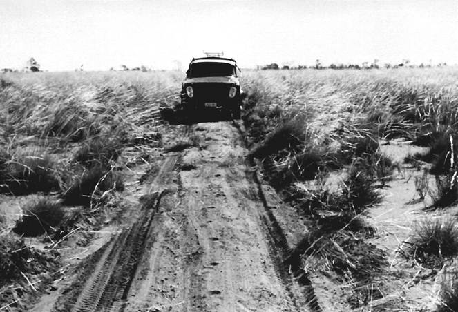
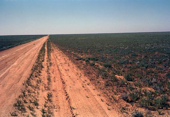
Figure 5: Observer’s vehicle, an International 4x4 utility, driving along the scraped track.
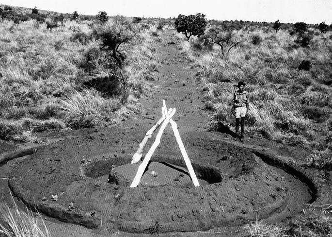
Figure 6: Completed Recovery Mark with R.A. (Reg) Ford, showing one half of the scraped base line. Tripod is smaller than usual; as larger trees became available more robust tripods were utilised.
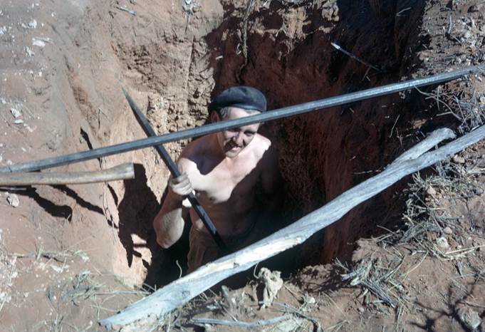
Figure 7: John Allen “down” the well (unofficially now the “John Allen Shaft” – Ed.).
It took six days to drive out, all vehicles were in poor condition, most having at least one broken spring. Instructions were now received from Canberra that some observing and measuring at WA Lands Department stations near Callawa was necessary to complete a missing link to ensure the connection to M6 was of first order standard, otherwise no firm connection with our traverse would be made. This task was completed and the observing parties moved to Port Hedland to join the heavy vehicles which had preceded them; it was now 9 October.
Port Hedland at this time had very poor facilities for vehicle repairs so it was decided to get the minimum done there and to proceed south to Kalgoorlie where better workshops and workmen were available.
During this period the Supervising Surveyor had battled his way up the Canning Stock Route crossing hundreds of sandridges often only one hundred yards apart. He selected and marked with bush tripods twelve stations on sandridges before reaching the firmer country and small hills north of Well 45.
He arrived at Billiluna HS with just a little petrol left and almost no food. He was finalising the Billiluna - Halls Creek section of the traverse as the observing party moved south. Between Well 35 and Halls Creek 23 stations were selected, vehicle distance 486 miles. Daily radio contact with R. Ford and O.J. Bobroff was maintained which cut some of the risk attached to this reconnaissance; however should anything serious have happened it is doubtful if the nearest party would have had enough petrol to get to the area by following wheel tracks, as it would have had to do, and then getting out again. Thus it was with relief that the party leaders received the news that H.A. Johnson had reached Billiluna.
Some long range radio conversations between Johnson-Bobroff-Ford were held during this reconnaissance. Probably the longest was at the conclusion of the reconnaissance; H.A. Johnson at Halls Creek, O.J. Bobroff at Cook and R. Ford at Kalgoorlie. The frequency used was 7465 mcs (now KHz) and the sets Traeger portable TM2 and one earlier model; a modified 51MA.
Winton, Qld - Broken Hill, NSW, Traverse
J.W. Witzand was party leader for this work. I. Johnson, R. James and I. Cameron would be observers and R. Maruff would join as a fifth observer when his course at the Army School of Military Survey had been completed. E. Burke would be a Tellurometer operator. As almost all the traverse had been beaconed and a considerable amount observed there was not a great amount of preparatory work.
The balance of the beacons south of Winton were erected and the section Winton - Mt Howitt was observed followed by the completion of the Tellurometer measuring. Simultaneous reciprocal azimuths were observed along every fourth line and simultaneous reciprocal vertical angles were observed along every line.
A short connecting traverse from the main traverse near Morney Homestead to a SA Lands Department traverse which came through that State and terminated at Beetoota Qld, was beaconed, observed and measured. Tellurometer measurements and simultaneous reciprocal azimuths were completed between Mt Howitt and Broken Hill.
A small amount of observing was done on the Mildura - Broken Hill traverse but it could not be completed until towers and scaffolding were available in that area. During the season 400 miles of complete traversing was done, an additional 350 miles of measuring only, and simultaneous reciprocal azimuths were observed along each fourth line of the full traverse.
Reconnaissance in Queensland
A.G. Bomford completed a helicopter reconnaissance between Dalby, Charleville and Mt Howitt generally along the line following the feasibility reconnaissance of 1960. In addition he reconnoitred the connection traverse from the vicinity of Morney Homestead to the vicinity of Beetoota.
Summary
With three field parties a great deal was accomplished in 1962, it was good to see the long north-south traverse Winton - Broken Hill fully completed, a start made to the long tower traverse across the Nullarbor Plain and with the junction at Well 35, the completion of a long traverse across the Great Sandy Desert of WA, right through to the main traverse loops in the NT
Statistics of the years work:
Kalgoorlie – Rawlinna, WA
Tellurometer traverse, simultaneous azimuth control incl. twelve towers - 240 miles.
Rawlinna – Forrest, WA
Reconnaissance, station marking, tower erection - 150 miles.
Callawa - Well 35, Canning Stock Route, WA
Tellurometer traverse, simultaneous azimuth control - 400 miles.
Mt Whinham – Vokes(*) Hill Junction - Muckera Rockholes area, SA
Tellurometer traverse including triangulation - 270 miles.
Muckera Rockholes area – Cook, SA
Tellurometer traverse, including eight towers, simultaneous azimuth control on tower section - 90 miles.
Cook – Ooldea, SA
Reconnaissance, station marking, tower erection - 90 miles.
Winton - Mt Howitt, Qld) and Morney H.S. – Beetoota, Qld
Tellurometer traverse, simultaneous azimuth control - 385 miles.
Mt Howitt, Qld - Broken Hill, NSW
Tellurometer measurements only, simultaneous azimuth control - 350 miles.
Well 35, Canning Stock Route - Halls Creek, WA
Reconnaissance, traverse distance - 320 miles.
Field Parties 1962
Mt Kintore – Vokes(*) Hill Junction - Muckera Rockholes, SA
O.J. Bobroff Surveyor Class 2.
D. Hutton Field Assistant (Survey).
R. Goldsworthy Field Assistant
N. Brownsea Field Assistant
J. Combe Field Assistant
H. Price Field Assistant WRE
G. Stanley Field Assistant WRE
D. White Field Assistant WRE
Muckera Rockholes - Cook, SA, Tower Traverse
O.J. Bobroff Surveyor Class 2,
R.A. Ford Senior Technical Officer Grade 1.
D. Hutton Field Assistant (Survey)
J. Pearson Field Assistant (Survey)
R. Scott Field Assistant (Survey)
R. Goldsworthy Field Assistant.
J. Allen Field Assistant
N. Stevens Field Assistant
N. Brownsea Field Assistant
J. Combe Field Assistant
A. Crowe Field Assistant WRE
G. Stanley Field Assistant WRE
H. Price Field Assistant WRE
Kalgoorlie - Rawlinna and Callawa - Well 35, WA, Traverses
R.A. Ford Senior Technical Officer Grade 1
A.S. Colvin Technical Officer Grade 1 (Kalgoorlie-Rawlinna only)
J.D. Pearson Field Assistant (Survey)
R.F. Scott Field Assistant (Survey)
G.J. Humphries Field Assistant (Survey)
F.J. Combe Field Assistant (Survey)
J.M. Carlisle Field Assistant (Kalgoorlie - Rawlinna only)
B. Campbell Field Assistant (Kalgoorlie - Rawlinna only)
I. McLean Field Assistant (Kalgoorlie - Rawlinna only)
M.J. Stevens Field Assistant
I. Yodgee Field Assistant (Survey)
J. Allen Field Assistant (Callawa - Well 35 only)
J. Coles Field Assistant WRE
P. Hallam Field Assistant WRE
A. Crowe Field Assistant WRE
Winton Qld - Broken Hill, NSW, Traverse
J.W. Witzand Surveyor Class 2.
I. Johnson Surveyor Class 1 - Graduate
I. Cameron Field Assistant (Survey) (short period only)
R. Maruff Field Assistant (Survey) (last half of year)
E. Burke Field Assistant
D. Shell Field Assistant
C. Golya Field Assistant
J. Zerbini Field Assistant
J. Perez Field Assistant
M. Mathwyn Field Assistant (short period only)
K. Richardson Surveyor Class 1
R. James Field Assistant (Survey)
S. Mattison Field Assistant
Eds Note (*): Correct spelling today is Voakes