Program 1967
The main factor influencing the 1967 field programme was the requirement to co-operate with the U.SA on the PAGEOS operation (Passive Geodetic Earth Orbiting Satellite) for world triangulation. See Technical Report No. 11, “Two Australian baselines for the PAGEOS world triangulation”, by K. Leppert, March 1972.
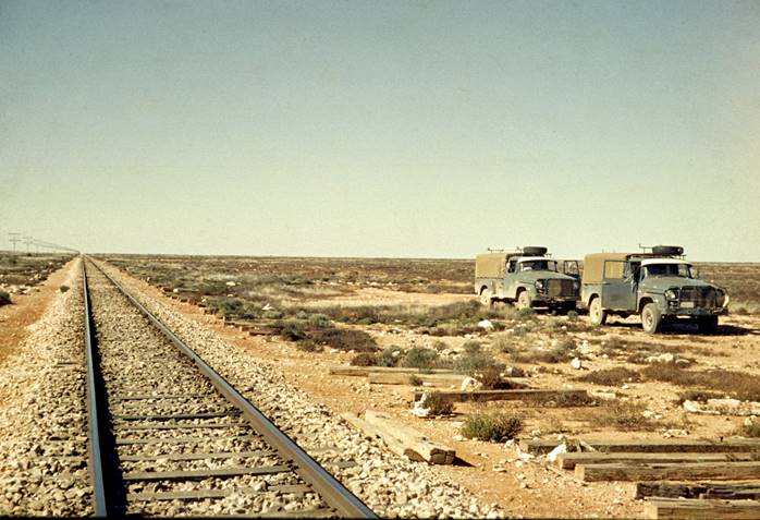
Accurate baselines of tremendous length were being prepared in four continents. Australia's contribution was to be an east-west baseline from Culgoora NSW, to Muchea, near Perth, WA and a similar north-south base line from Thursday Island, Qld to Culgoora. Wild BC4 camera sites were to be established at Thursday Island, Culgoora and Muchea.
National Mapping's first contribution to this task was the fixing of the Culgoora camera site in 1966. The next steps were to be the connecting traverse between first order stations Mt Kaputar and Mt Bendemeer, followed by high precision measuring of all Tellurometer lines across the continent between Culgoora NSW, and Muchea WA, and then between Culgoora and Thursday Island. On the latter some entirely new work was required. For the high precision measuring MRA-4 Tellurometers were purchased after the evaluation of available EDM equipment.
Taking the above requirement into account, the fact that A. Roelse had transferred to the Canberra office, and some of the experienced observers would not be available, the following field programme was drawn up:
(i) Testing and evaluation of EDM equipment.
(ii) High precision measuring along existing Tellurometer lines, Perth to Culgoora.
O.J. Bobroff would direct this operation, field party leader A. Porteous.
(iii) Theodolite/Tellurometer second order mapping control traversing including track making in the Port Hedland - Marble Bar - Warrawagine areas, WA.
(iv) Theodolite/Tellurometer second order mapping control traversing by helicopter in the Port Hedland, Roebourne, Millstream and Mt Newman areas, WA R. Ford and his field party would be available to assist in this survey.
O.J. Bobroff would direct this operation, party leader P.H. Langhorne.
(v) Theodolite/Tellurometer first order tower traverse Mt Kaputar - Mt Bendemeer, NSW
J.W. Witzand would direct this operation, field Party leader R.A. Ford.
Other factors which had to be taken into account in preparation for the season's work were the critical shortage of experienced observers, the acquiring of equipment for the further attempt at track making required by the Supervising Surveyor, and a requirement to compile a set of specifications for second order traversing suitable to cover such work done under contract. Over the years 1967, 68 and 1969 an enormous amount of non-continuous work was put into these “specifications” by numerous officers.
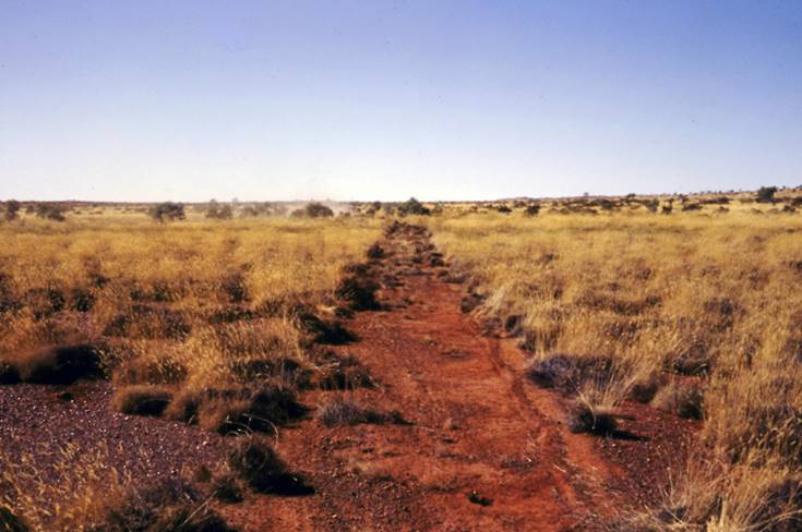
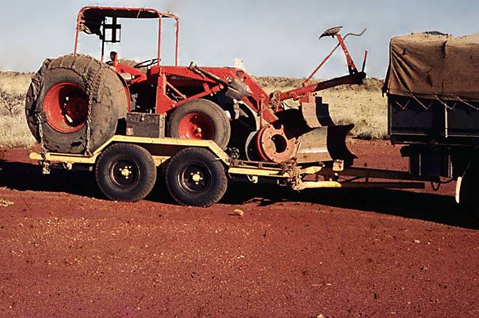
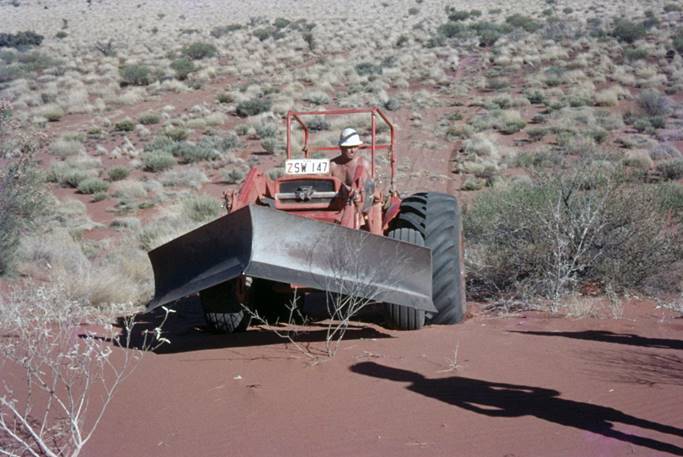
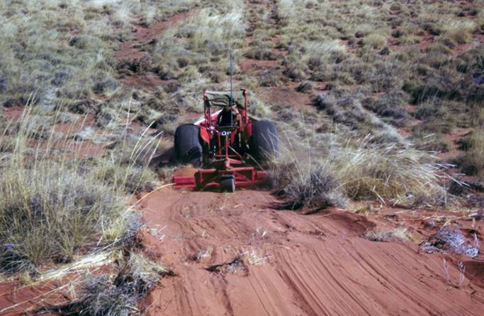
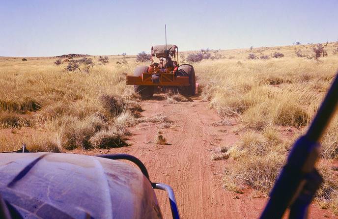
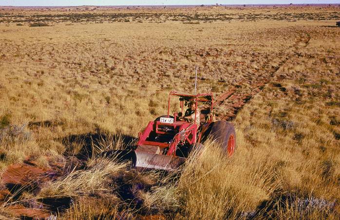
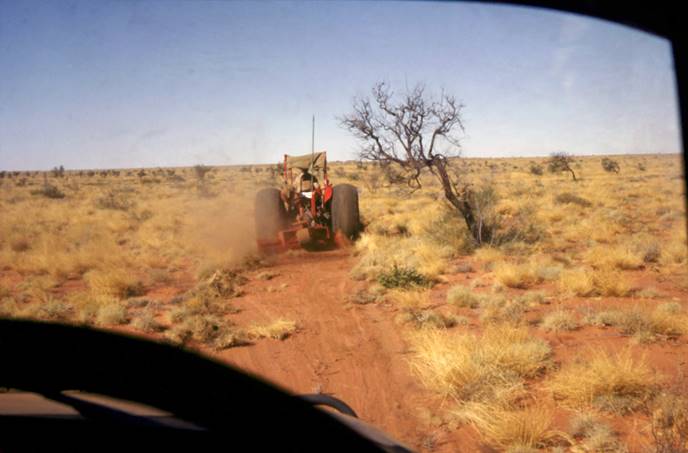
For the track making, a Ferguson tractor was purchased, fitted with a blade and special large smooth tyres for sand use. Some testing was done in sandy terrain near Melbourne and the equipment certainly had a greater chance of success than the vehicle-towed scrapers previously tried. This project was not as easy as it sounds and it took a lot of time and patience to get the equipment suitably modified.
Theodolite/Tellurometer second order mapping control traversing, Marble Bar-Warrawagine area, WA
P.H. Langhorne was field party leader and was the only experienced observer in the party. D. Girvan who had attended the School of Military Survey, Basic Survey Course, D. Roberts and E. Ainscow both of whom had been given theodolite/Tellurometer training were to be the observers and V. Bosnic who was currently at the School of Military Survey would join the party in July. Most of the field assistants were new.
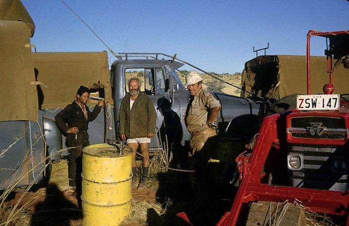
The equipment went by container to Stores and Transport, Karrakatta WA, where the vehicles had been left by the previous field party at the end of 1966. The field party left by air for Perth early in May and on arrival collected their vehicles, loaded equipment and proceeded to the Port Hedland - Marble Bar area. The Bedford with the Ferguson tractor on its trailer would follow a little later.
The first traversing was centred on the Marble Bar area, and luckily the terrain was very suitable for this type of work. There were plenty of rocky hills of distinctive appearance, and varying heights and with relatively bare crests.
The reconnaissance was not difficult but the organising and controlling the observing was the most difficult part for the party leader, owing to the lack of experienced observers and bookers. As the observing teams gained experience under his instruction, work speeded up and became of better standard. V. Bosnic arrived and he too had to be given the required field training before taking his place as an observer.
When the traverses in the Roy Hill - Marble Bar area were completed the field party commenced on the long 190 mile traverse along the 21° parallel of Latitude from Warrawagine to the first order traverse station NN/F/178, Longitude 123° 10' 58”. From there they turned north to the traverse of the previous year which was along the 20º parallel of latitude, joining it at NM/F/325, longitude 123° 07' 51”, overall distance including spurs, about 280 miles.
The tractor was in action in this area and the track it made northward across the close parallel sandridges contributed greatly to the success of that part of the survey. However as the driver was a new field assistant unfamiliar with the survey party's requirements, overall the tractor was not used to its greatest potential. The party leader had a fulltime job in reconnaissance, supervising the marking/observing parties and ensuring the mapping control points fulfilled photogrammetric requirements; he had no chance to also supervise track making operations.
This desert traversing was completed at the end of August, the field party then moved to Port Hedland for rest days and vehicle maintenance. The field party had completed to that date:
Roy Hill - Marble Bar (hilly area) 23 new stations, 7 established stations. Distance 390 miles.
Warrawagine area (sandridges) 24 new stations, 6 established stations. Distance 280 miles.
Helicopter traversing and spot photography, Port Hedland, Millstream and Mt Newman area, WA
The ex-NSW field party joined P.H. Langhorne on 5 September. The following arrangements were made to facilitate the helicopter work:
(i) P.H. Langhorne would be in charge, and would control the observing parties and their movements.
(ii) R.A. Ford would be second in charge, he would organise the spot photography and would do all the book work associated with the helicopter contract.
(iii) J. Fox would be the photographer using the 35 mm hand held Nikon Camera with wide angle lens.
(iv) J. Patrick would take a small party including E. Ainscow and I. Munro as observers. They were to complete a programme of short theodolite/Tellurometer connections to mapping control points.
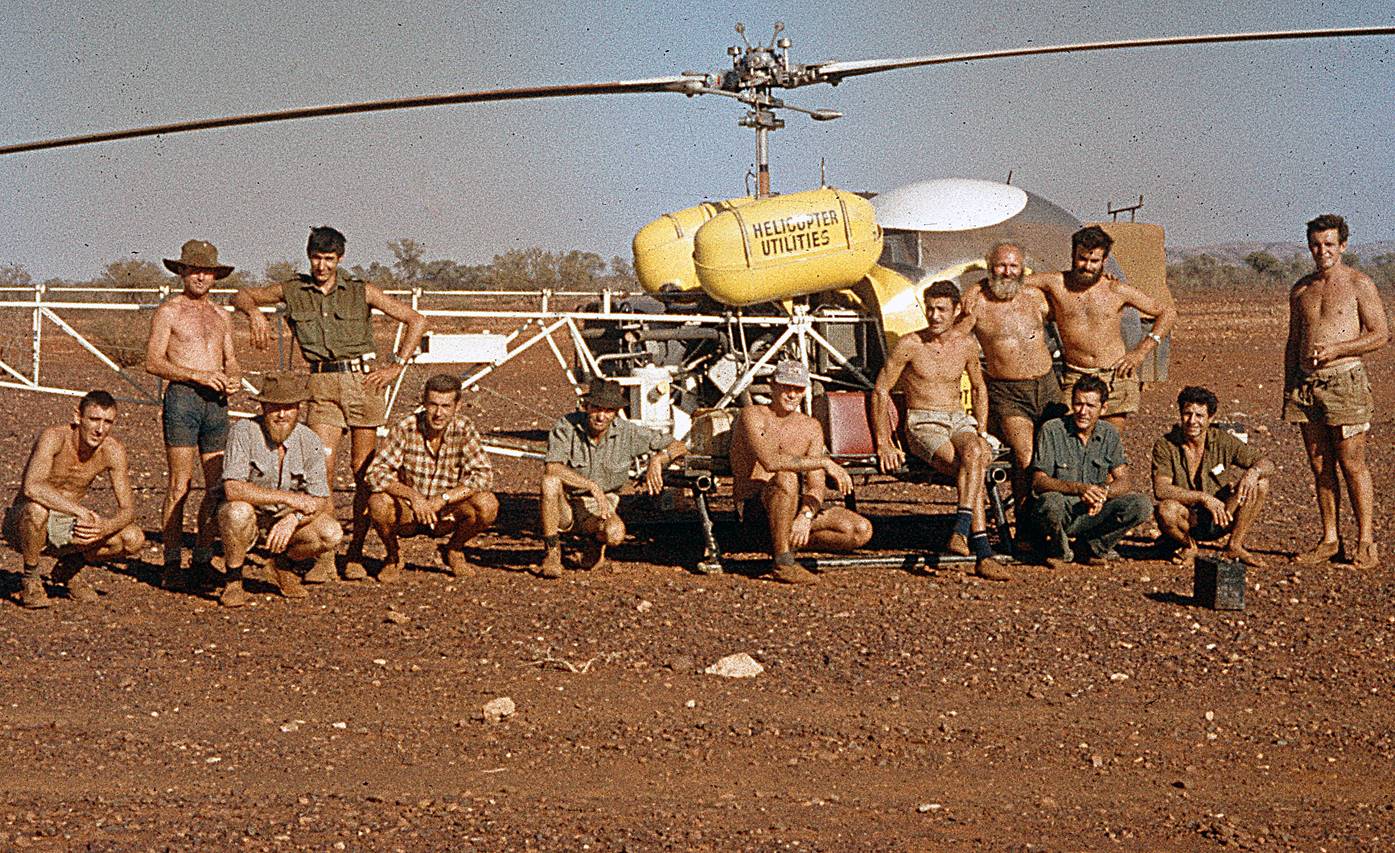
As the helicopter contract was to start at Marble Bar and the traversing was to start near Roebourne, R. Ford and J. Fox went to Marble Bar to meet the helicopter and organise a spot photography programme which would clear up the northern area, en route Roebourne. The helicopter contractor was Helicopter Utilities, the aircraft a Bell 47G-4, and the pilot was Phil Latz who turned out to be one of the best and most co-operative pilots to work on National Mapping contracts.
The spot photo programme Port Hedland to Roebourne took 2½ days, eight stations being completed. Immediately the helicopter arrived at the Pyramid Homestead camp near Roebourne, P.H. Langhorne went on reconnaissance selecting the stations required to get the traverse started and then immediately sending in the first observing parties. This system was followed throughout the contract, keeping the reconnaissance a few stations ahead of the observing parties from each base camp.
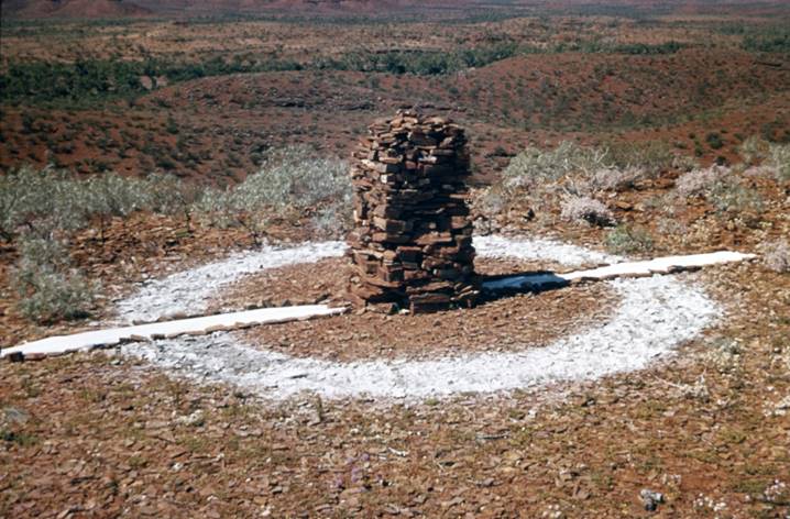
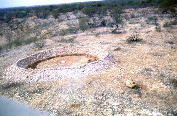
This first traverse took only 9 days and was done from two base camps - Pyramid and Millstream. Millstream was a delightful camp beside a large fresh water stretch of the Fortescue River. Eight stations were occupied and 7 Tellurometer measurements taken, approximate distance 140 miles. In addition all required stations in the area were spot photographed. Figure 1 shows the type of station marking adopted for both helicopter and orthodox traverses during 1967 and 1968.
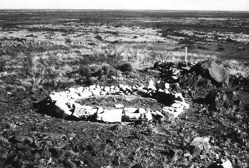
Figure 1: Station mark, white washed circle of rocks and witness post as used on mapping traverses during 1967 and 1968.
The field party then moved to the Wittenoom area and a new pilot took over. From here some short connections to mapping control points were made and the main body of the field party moved to the Mt Newman area while the helicopter remained to complete the spot photography. During this trip it was noticed that the new pilot Bob Thurston, a Canadian, was having difficulty in navigating, in what to him was comparatively featureless country.
It was therefore decided that for the long flight to the new base camp near Mt Newman, R. Ford would go as passenger to assist with the navigation. On this trip about midway between Roy Hill and Mt Newman while flying at about 800 feet there was a loud bang, the helicopter began to vibrate badly and tended to tip forward onto its nose. Switching off the engine stopped the vibration and the pilot did a good job to get the aircraft down. He had to exert considerable force on the controls to keep it from tipping forward and eventually managed to land rather heavily and still with forward movement, in a clear area among mulga clumps.
Inspection showed that a “conn” rod in the engine had come adrift and gone through the rear cover plate of the engine, damaging the rotor controls which run vertically in that area. The pilot was able to make radio contact with Port Hedland giving the aircraft's position; they contacted Mt Newman airstrip where the helicopter engineer was informed.
The helicopter was down in a remote area, the nearest station, Marilanna was about 40 miles to the north west and the main road was about 18-20 miles east. It was within a few miles of where the Mt Newman - Port Hedland railway line now runs.
Under these circumstances it was unbelievable that soon after the radio message had been passed, a boundary rider from Marilanna Homestead on a motor bike came through the scrub. He was out on his rounds, saw the helicopter in the air and thought it then landed and so came looking for it to see what was going on. He returned to the homestead and arranged a vehicle which picked up the pilot and R. Ford in mid-afternoon. On the way to the homestead via the pegged survey line for the new railway, they met the helicopter engineer who had come looking for the aircraft. After taking the engineer back to inspect the damage all went to the field party’s base camp near Mt Newman.
Helicopter Utilities did a good job in getting the aircraft flying again. The incident happened on Thursday, they flew in a new engine to Mt Newman by Sunday; it was taken by vehicle through the bush to the aircraft, installed and the aircraft flew to the base camp late Monday afternoon.
The task in the Mt Newman area was a traverse around the perimeter of the 1:250 000 scale map sheet plus one control point in the approximate centre of the map sheet.
All started well, the base camp was moved to Welli Wolli as the traverse progressed westward. Then after one week there was further helicopter trouble. With three parties on the hills and due to come down, the helicopter could not be started at the base camp on Saturday morning. New magnetos were required from Sydney; as this would take at least three days it was necessary to get the observing parties down by vehicle.
It took 2 days to get D. Hutton from Mt Robinson and 1 day to get D. Girvan from NM/F/505. V. Bosnic walked down from Mt Newman which was no difficulty. D. Roberts could not be reached by vehicle from Welli Wolli so it was decided to try and drop food and water to keep them going until the helicopter was flying again; this was not particularly successful.
R. Ford and J. Fox then went to Mt Newman for the helicopter parts; when these did not arrive on the Tuesday afternoon plane it was decided in consultation by radio with P.H. Langhorne at Welli Wolli that they should evacuate D. Roberts and his booker by vehicle from the north side of the range.
They went immediately and just on dark got to the nearest point on a track to D. Robert's position on the long range. By radio, lights were arranged to identify the point. This was seen and marking sticks placed so the exact point could be identified in the daylight.
They headed for this point at daylight keeping radio contact at regular intervals. By 1400 the vehicle was in a tangle of gullies as near as possible by vehicle to the observing party’s position. The only way to get them to the vehicle was by leading them down. J. Fox climbed through the gullies to the traverse station and brought them back to the vehicle arriving at the large beacon fire in the gully about 1 hour after dark.
The helicopter was out of action for 6 days resuming flying on 13 October and completing the contract without further delay. The only blemish was the pilot getting lost while travelling on his own and thus worrying the party for some hours until his whereabouts were known.
In the Mt Newman area 22 stations (17 new and 5 established) were occupied in 25 days (less 6 days helicopter grounded) the distance traversed was about 360 miles.
Overall during the contract about 30 stations (22 new and 8 established) were occupied plus some minor work near Wittenoom. The overall time was 6½ weeks (less 10 days helicopter grounded).
On this contract it was shown that spot photo work by helicopter which is not part of the traversing programme is very uneconomical; besides the photographer it is necessary to have two men and a support vehicle large enough to carry 44 gallon drums of Avgas plus the pilot's and photographer's camping equipment, food etc. The helicopter has to meet this support vehicle at least once during the day to refuel. The aircraft has a relatively slow rate of travel and a slow rate of climb to get to the required 3000 feet after marking the station for photo identification. Owing to these restricting factors only about four spot photographs were completed each day during this helicopter contract.
This does not compare very well with up to 16 spot photos at pre-marked stations completed in one day by cheaper to operate fixed wing aircraft which needs no support vehicle. The only advantage of the helicopter was its ability to enable the photographer to land, identify and mark each station immediately before taking the photographs.
During the period of the helicopter contract 35 spot photographs of traverse stations were taken. Some of these were on special photographic missions while others were dovetailed in with the normal helicopter operations of the traversing party. At the conclusion of the contract a fixed wing aircraft was hired and J. Fox completed a further 25 to 30 spot photographs of pre-marked stations.
At the conclusion of the helicopter contract on 26 October P.H. Langhorne was instructed to investigate track making with the tractor in the nearest sandridge country. He spent about a fortnight overall trying various methods, and in general achieved some satisfactory results and returned to Melbourne with photographs and a written report of his investigations.
Onslow - Port Hedland area. WA - Control point connections to existing traverses & station marking for spot photography
During September and October J. Patrick, Surveyor Class 1 under the direction of P.H. Langhorne, was engaged in making theodolite/ Tellurometer connections to selected mapping control points in the coastal area between Onslow and Port Hedland, E. Ainscow and I. Munro were the observers allotted for these tasks.
In addition these control points were marked for photo-identification so they would show on the spot photographs to be taken by J. Fox. Selected established stations in suitable position for mapping control were also marked.
This field programme was completed about one week prior to the conclusion of the helicopter traversing; the field Party then returned to Melbourne ahead of the main traversing party.
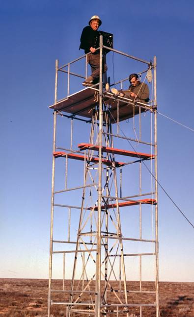
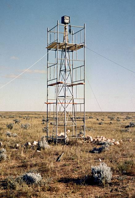
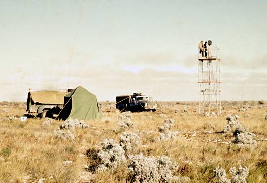
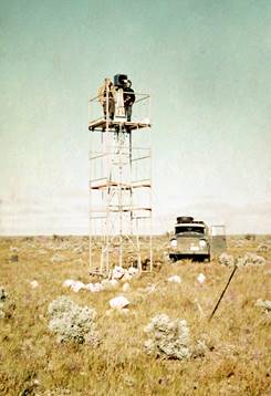
Mt Kaputar - Mt Bendemeer, Qld, First Order Tower Traverse
R. Ford was party leader, a newly graduated Surveyor Class 1, J. Patrick was attached to the field party to be trained in observing and National Mapping field party management and technique; he would be second in charge. The other observers were D. Hutton and J. Fox; I. Munro was to be given training in observing.
The recommendation that 60ft or higher towers be used was not accepted and the instruction was given to use the existing equipment and the cleared line of the road where this was the only possible means of advancing.
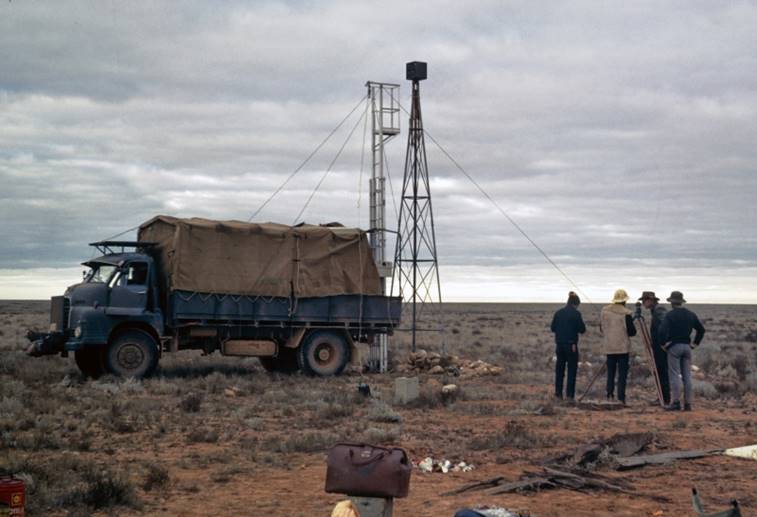
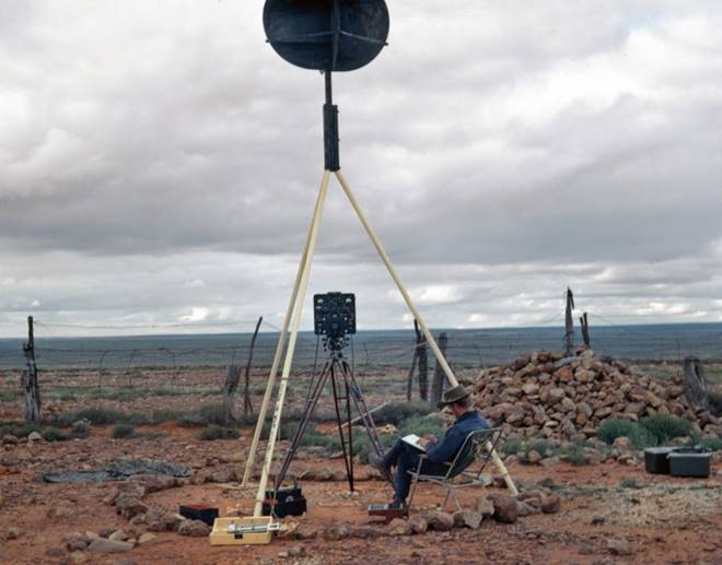
To assist in the reconnaissance a very light but robust aluminium extension ladder with a work platform at the top, was purchased; this could be run up in a few seconds and when tied vertically to the back of a Bedford of International, provided an 18 foot eye level view in comparative safety. This proved a valuable acquisition; a second ladder was taken to the Nullarbor Plain by the high precision measuring party.
The field party left Melbourne on May 1 and started observing on May 5. Trouble was experienced in measuring the first line Kaputar - Rossmore which was a long, low line of 65 miles. One measurement with the MRA-3 Tellurometer had been made in 1976 before work was abandoned in continually wet weather, however the line could not be measured with the MRA-2 Tellurometer either from ground level or the top of the 30 foot tower. The only alternative was to put in an extra station to shorten the line.
From Rossmore westward every attempt was made to see across country but our 30 foot towers had no hope of achieving this as the trees were higher. As expected the only method of advance was along the cleared line of the road and as the straights of the road were so short, 10 foot towers at each bend were sufficient to give the required visibility.
Progress was slow but at least the movement was steadily forward. Two nights observations were taken, if they disagreed by over one second of arc, another nights observations were taken. With the Tellurometer measurements, those under 1½ miles often did not agree within 1:150 000; in these cases a third measurement was taken. However when some small instrumental index corrections, which were not available to the field party at that time were applied later the measurements in question were within the required specifications.
When the traverse was about half completed, J.W. Witzand arrived to assess the situation and to see if any alternative method could be used. After inspecting the area he agreed that the method being used was the only possible one in the circumstances. His visit coincided with heavy rain which made the roads boggy and prevented movement for some days so he had to return to Melbourne.
F.J. McCoy, Surveyor Class 1 from Canberra arrived soon after and commenced a Laplace observing programme on selected stations of the section of the traverse so far completed.
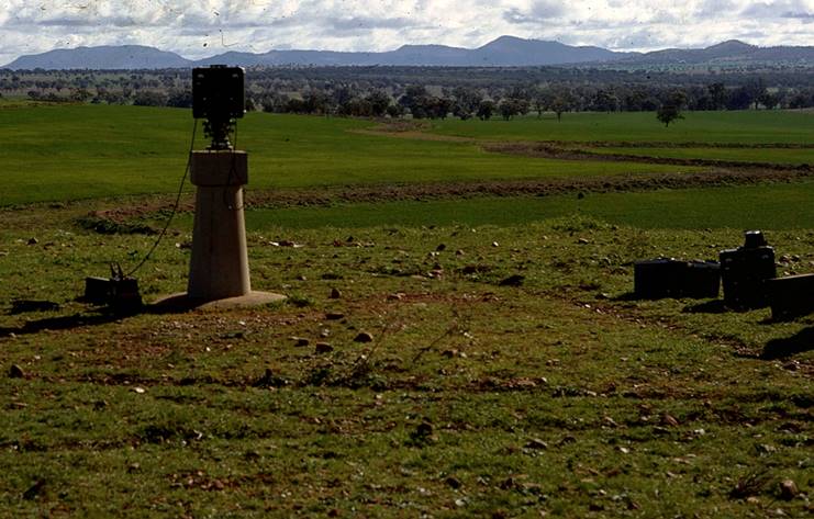
The traverse party observed simultaneous reciprocal azimuths on every fourth line (10 in all). Field computations were kept up with the observing by the party leader to continually assess the standard. It was found there was a continuous slight drift always in the one direction, between the carried forward geodetic azimuth and the mean of the simultaneous reciprocal astronomical azimuths; no amount of care or extra observations could prevent this. Overall it amounted to about 11 seconds of arc over the 36 stations and 207 miles of the traverse. Eleven 10ft towers were used; seventeen 30ft towers and eight were ground stations. Also two Aerodist stations were connected to the main traverse, one by a spur traverse of 4 stations and the other by a chained connection and bearing.
During this traverse J. Patrick, Surveyor Class 1, and I. Munro Field Assistant were given considerable training in both observing and measuring with the Tellurometer; they then formed an observing party each doing 50% of the technical work.
The traverse was completed to Mt Bendemeer by 1 August in cold and wet conditions. It was of first order standard, the close on Mt Bendemeer being quite satisfactory; however the large number of short lines didn't impress when considering the traverse as part of the high precision base line, Culgoora to Muchea. From Rosemore the most easterly tower station, to Mt Bendemeer there were 34 towers in only 140 miles.
The field party immediately returned to Melbourne where its stay was of short duration. J. Patrick with a small party left almost immediately to prove lines and beacon a few stations to link Muchea with the main geodetic scheme near Perth; these had to be prepared for the high precision measuring party who would be in the area later in the year.
During the stay in Melbourne a series of conferences were held between the Assistant Director, O.J. Bobroff and R. Ford to sort out the programme of helicopter work in WA. The Assistant Director required a rather complicated programme of spot photography and Tellurometer connections which was to include numerous old WA Lands Department triangulation stations to bring them into use for mapping control. Eventually all was satisfactorily resolved; it was agreed R. Ford would look after this aspect of the work plus the day to day book work associated with the helicopter leaving P.H. Langhorne free to do the reconnaissance and control the traversing party which would now have two more experienced observers in J. Fox and D. Hutton, both of whom were used to helicopter operations. In addition J. Fox was selected to do the spot photography.
The field party including J. Patrick's beaconing party assembled in Perth on 2 September and joined P.H. Langhorne at Port Hedland on 5 September.
High Precision Measuring Muchea, WA - Mt Finke area, SA
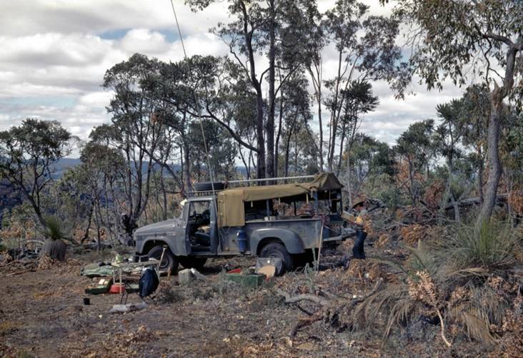
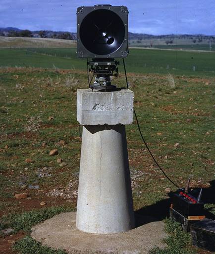
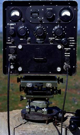
The Tellurometer MRA-4 was chosen as the most suitable EDM equipment currently available for the high precision traversing. As the equipment was late in arriving only familiarisation tests were able to be made before the field party left Melbourne.
The party leader was A. Porteous, Surveyor Class 1, with A. Wright and D. Yates as observers; three Field Assistants made up the balance of the party. They moved to Cook, SA, early in July and commenced measuring towards Perth.
The towers which had been left in position in 1963 saved considerable time and manpower. To make further savings in this area “Quicklift” scaffolding was used. Scaffolding suitable for a twenty foot tower can be erected by two men in less than half an hour. With some difficulty owing to its small base, it was with care also used in conjunction with the few 30 foot towers along this traverse.
Using this equipment the very small party was able to complete the tower section and then the normal stations from Zanthus to Muchea by early October. In the Perth - Muchea area some second order theodolite work was also completed.
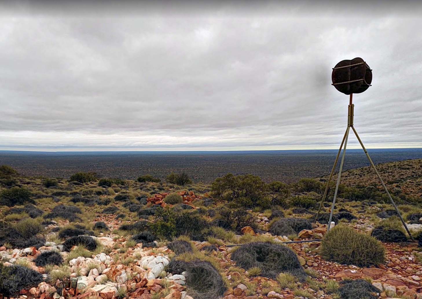
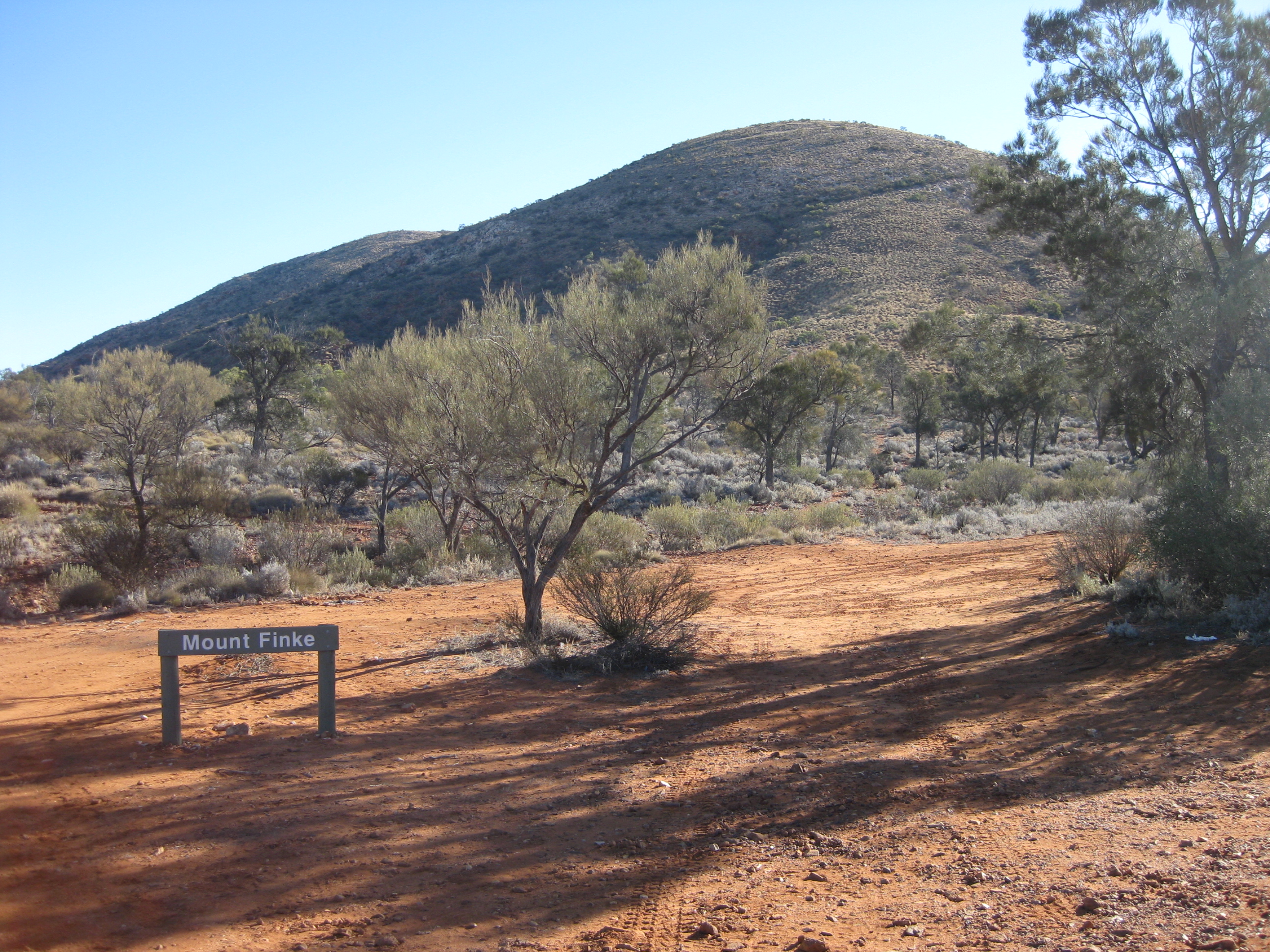
The party then moved back to Cook and commenced measuring eastwards. They completed as far as the vicinity of Mt Finke (near Tarcoola) before returning to Melbourne in early November. During the season approximately 103 lines were measured.
|
|
|
|
Quadrupod (missing leg on ground) on Mt Finke (Google Maps 2021) |
Mt Finke, South Australia (courtesy Lawrie O'Connor, 2012) |
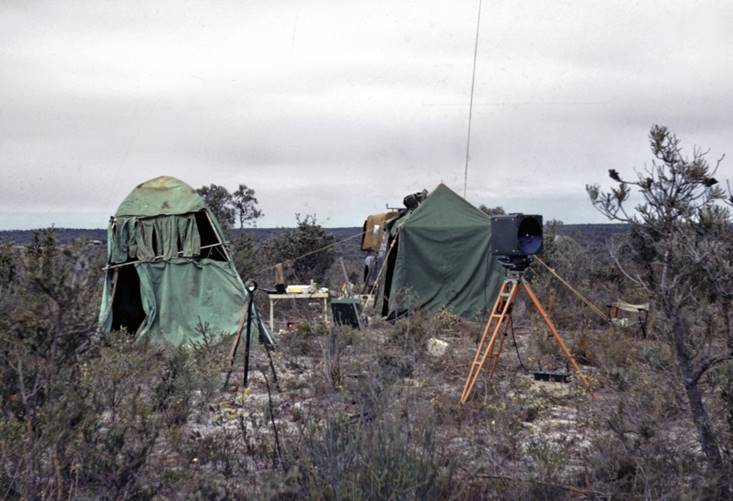
From mid-November - mid December and also in February 1968 extensive tests of all Tellurometer Models, MR-1, MRA-2, MRA-4, 101 and the Wild Distomat were carried out at the Benambra Base in Victoria.
Field Parties 1967
WA Second order Mapping Control traversing (by vehicle)
P.H. Langhorne Surveyor Class 1
D. Roberts Technical Assistant Grade 2
E. Ainscow Technical Assistant Grade 2
D. Girvan Field Assistant
V. Bosnic Technical Assistant Grade 2
R. Francis Field Assistant
A. Wild Field Assistant
J. Millington Field Assistant
D. Lewington Field Assistant
J. Welch Field Assistant
O. Gyles Field Assistant
E. Skeen Field Assistant (WRE)
L. Manno Field Assistant (WRE)
WA second order Map Control traversing (by helicopter)
P.H. Langhorne Surveyor Class 1
R.A. Ford Senior Technical Officer Grade 1
D. Hutton Technical Assistant Grade 2
J. Fox Technical Assistant Grade 2
D. Roberts Technical Assistant Grade 2
D. Girvan Field Assistant
V. Bosnic Technical Assistant Grade 2
R. Francis Field Assistant
A. Wild Field Assistant
D. Lewington Field Assistant
J. Welch Field Assistant
O. Gyles Field Assistant
E. Skeen Field Assistant (WRE)
L. Manno Field Assistant (WRE)
J. Patrick Surveyor Class 1 ) Detached party under
E. Ainscow Technical Assistant Grade 2 ) P.H. Langhorne on
I. Munro Field Assistant ) control point connections
J. Millington Field Assistant ) by vehicle
Mt Kaputar - Mt Bendemeer, NSW first order tower traverse
R.A. Ford Senior Technical Officer Grade 1
J. Patrick Surveyor Class 1
D. Hutton Technical Assistant Grade 2
J. Fox Technical Assistant Grade 2
I. Munro Field Assistant
P. Blake Field Assistant
T. McMillan Field Assistant
K. Wachtel Cadet Surveyor - Short period only
F. Maguire Field Assistant
Muchea, WA - Mt Finke area SA, high precision measuring
A. Porteous Surveyor Class 1
A. Wright Technical Assistant Grade 2
D. Yates Technical Assistant Grade 2
J. Martin Field Assistant
J. Houser Field Assistant
T. Wignell Field Assistant