Field Surveys at Mawson – 1966
From reports by John Gordon Quinert L.S.,
Surveyor Mawson 1966
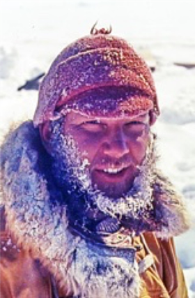
John Quinert (Photo by Max Cutcliffe).
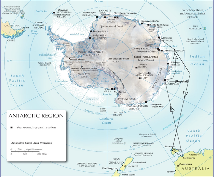
1966-1967 : MV Nella Dan outward & return routes.
Mawson Surveyor’s Program 1966
The following table shows the program of work undertaken during 1966.
|
Task & Duration |
Personnel |
Speciality or Designation |
|
18 - 28 February 1966 Glaciology & Survey Lucas Nunatak |
Koshiro Kizaki
(Leader) Reginald (Pat) Lee |
Glaciologist Surveyor Radio Operator Diesel Mechanic
|
|
10 – 21 March 1966 Depot Trip Mount Twintop
|
Kenneth Morrison (Leader) Maxwell Cutcliffe John Quinert William Edgar |
Base Officer in Charge Electrical Fitter Surveyor Senior Diesel Mechanic
|
|
6 – 10 April 1966 McNair Nunataks
Painted Hill |
John Quinert (Leader) John W Hudson H Allan Williams Ronald Murray (Leader) Peter Towson |
Surveyor Medical Officer Senior Technician (electronics) Weather Observer (radio) Geophysicist
|
|
21 – 25 April 1966 McNair Nunataks
Painted Hill
|
John Quinert (Leader) Maxwell Jones Geoffrey Butterworth Ronald Murray (Leader) William Cartledge |
Surveyor Assistant Diesel Mechanic Radio Operator in Charge Weather Observer (radio) Carpenter
|
|
25 May – 2 June 1966 McNair Nunataks
|
John Quinert (Leader) Peter Cronly |
Surveyor Glaciologist Radio Technician
|
|
August 1966 Bechervaise Island |
John Quinert Ron Murray |
Surveyor Weather Observer (radio)
|
|
6 – 16 September 1966 Mount Twintop |
John Quinert (Leader) Maxwell Cutcliffe Thomas Crothers |
Surveyor Electrical Fitter Radio Operator
|
|
9 October – 30 January 1967 Spring PCM Traverse |
John Quinert Kenneth Morrison Maxwell Cutcliffe Maxwell Jones William Cartledge Gordon Whitehouse George Cook |
Surveyor Base Officer in Charge Electrical Fitter Assistant Diesel Mechanic Carpenter Radio Operator Meteorological Observer
|
The October to January, Spring traverse into the Prince Charles Mountains was the primary survey and mapping work for the year. As such it is detailed first with the remaining work briefly summarised thereafter.
Survey Project 4/1966 : Spring Tellurometer Traverse
October 1966 - January 1967
AIMS
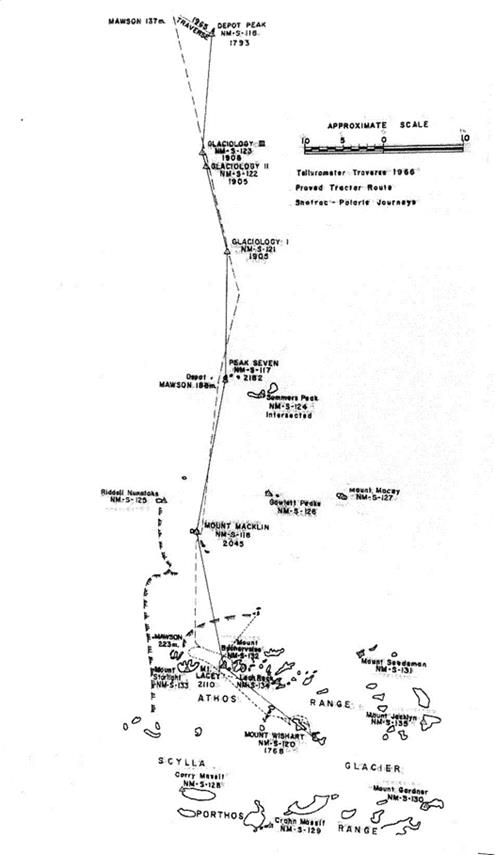
To continue existing Tellurometer traverse from Depot Peak to connect Frammes Mountains with the Prince Charles Mountains proceeding south via Stinear and Anare Nunataks.
To map features in Stinear and Anare Nunataks and surrounding outliers and features in Athos Range by intersection from Tellurometer traverse points.
To obtain astronomical azimuth at Twintop as for amended Project 1/1966.
(see separate report)
Where practicable to mark and fix safe routes through country used during the survey
Time permitting to collect geological specimens for Bureau of Mineral Resources.
PERSONNEL
|
J. Quinert |
Surveyor |
|
K. Morrison |
Base OIC |
|
M. Cutcliffe |
Electrician |
|
M. Jones |
Diesel Mechanic |
|
W. Cartledge |
Carpenter |
|
G. Whitehouse |
Radio Operator |
|
G. Cook |
Meteorological Observer |
VEHICLES
|
3 |
Caterpillar D4 Bulldozers |
|
2 |
Porsche Snotracs |
|
2 |
Polaris Motorised Toboggans |
|
1 |
Fibreglass Caravan |
|
2 |
Articulated Caravans |
|
2 |
Smiths Sleds |
|
1 |
Half Norwegian Sled |
|
4 |
Norwegian Sleds |
COMMUNICATIONS
|
3 |
ANGRC 9 TX-RX |
|
1 |
SCR7 TX-RX |
|
1 |
AWA 5A TX-RX |
|
2 |
R209 RX |
|
2 |
Vaughan Walkie-Talkie TX-RX |
NAVIGATION EQUIPMENT
3 Astrocompasses with mounts on all D4’s and Snotracs
1:100,000 Compilation sheets Frammes Mts. to Porthos Range
1:500,000 Compilation sheets Frammes Mts. to Porthos Range
Nautical Almanac
Astrocompass LHA sheets
Astrocompass operation instructions
SURVEY EQUIPMENT
SEE APPENDIX I
PREPARATION AND PLANNING
Only one meeting of party members was held prior to departure and many important details were left in a very vague state, such as clarification of duties expected of party members, instruction and practice in theodolite operation and navigation instruction.
Preparation of equipment was carried out as follows :
|
Food and Fieldstore equipment |
Max Cutcliffe |
|
Survey Gear and beacons |
John Quinert |
|
Met gear and beacons |
George Cook |
|
Vehicles and sleds |
Max Jones |
|
Radio |
Gordon Whitehouse |
|
Fuel |
Ken Morrison |
Owing to the lack of pre-departure practice, detailed operation instructions were duplicated for Tellurometer, theodolite and astrocompass. A strip was made from the 1:100 000 scale compilation sheets from Mawson to the Porthos Range and a Latitude-Longitude graticule marked onto it.
Also a 1:500 000 scale compilation sheet was marked into 0.1 degree Latitude and longitude over the proposed route for the Met. Observer.
PROPOSED FIELD PROCEDURE
Using 3 D4 ‘s to take trains to Mount Twintop
Obtain astronomical azimuth at Twintop
Proceed to Peak Seven and erect beacon, forward party to Mount Fox or Mount Macklin.
Obtain Tellurometer measurement Peak Seven to Mount Fox
Beacon Mount Fox
Climb Mount Bechervaise for reconnaissance of the two proposed routes, east or southeast.
Complete traverse to Mount Jacklyn either via northern rock outcrops or Weasel Gap and Moore Pyramid area
Return along outward route reading horizontal angles and obtaining astronomical position and azimuth at some suitable traverse station.
Repair beacons at Mount Twintop and Painted Peak if time permits
Personal selection of survey stations by Surveyor
Depoting of D4 at Mount Hordern Our camp at Max Corrie’s Depot Peak
TRIP SUMMARY
Departed Mawson on the ninth October in fine weather and camped halfway between Rumdoodle and Fang Peak for the night. The band of crevasses on the last leg toward Fang Peak was marked at each end on returning from the Autumn trip and knowing their direction the train diverged to the south before reaching the first drum and then headed for the north end of the David Range, crossing the crevasses at right angles and on reaching a point opposite the flag at the west end of the crevasses, turned back toward Fang Peak and no breakthrough occurred. On reaching Hordern Fuel Depot the return route of the autumn trip was again used and we again passed through without any trouble. Good progress was made from here and we arrived at Twintop Depot at midday on the eleventh. Extra fuel was then loaded onto the sleds and we continued on to Mount Twintop and depoted survey gear on top in preparation for astros. The next eight days were spent waiting unsuccessfully for clear weather but one star and one sun observation were obtained before proceeding south, leaving the one D4, ‘Clappa’, at the turnoff to the mountain on blue-ice and distributing the sleds between the remaining D4’s. Arrived at Depot A on the 23 October where more fuel was picked up and then continued between spells of bad weather arriving at Depot B on 4 November. Travelled to Depot Peak in the Snotrac to evaluate the possibility of connection direct to Peak Seven but only Summers Peak and the adjacent peak to the west were visible, being very badly mirage and broken up. Continued south reaching Rum Depot on 7 November where the gear was rearranged for the forward party to move to Mount Fox or Mount Macklin whilst a pontoon repair was carried out on the workshop caravan.
Max Cutcliffe and myself formed the forward party and we departed Depot Rum on the 8 November in the Snotrac and travelled to Mount Macklin, which was subsequently selected as the forward control point and station with eccentric points on Peak Seven selected whilst passing. The rear party erected a two drum beacon on Peak Seven and the Tellurometer measurement and reciprocal verticals were completed, a Heliograph being maintained at Macklin for the observer at Peak Seven. The rear party then moved up to Macklin and a two-drum beacon was also erected there.
Having previously studied the route between Macklin and Weasel Gap there appeared to be a choice of either heading straight for Mount Béchervaise or the western side of Weasel Gap which appeared to pass between two areas of crevassing just north of the Gap. Choosing the latter we headed south and passed onto the low ground along the northern front of the range through a low point in the ridge flanking this area to the north and striking no crevassing until down onto the flat. On attempting to head straight through to the Gap we met with very large crevasses. After a reconnaissance on foot, I decided to try further to the east. But after crossing a few more crevasses in the intervening ground one of the bogey mounts broke and the Snotrac had to be carefully led north onto relatively safe ground to enable the welding unit in the workshop caravan to be brought up to it. This then became the base camp for all further operations in the area as the D4’s hadn’t even enough fuel to get back to Depot Rum as it was.
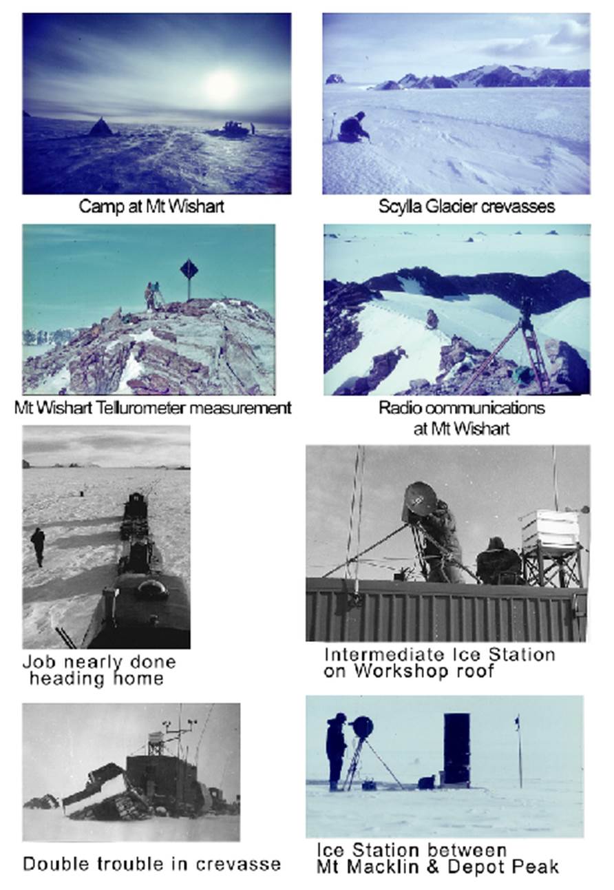
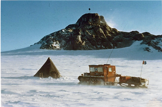
The following day Max Cutcliffe led a party of four including myself to the top of Mount Béchervaise and a rock cairn was placed on the highest point. The surface within and south of the Athos Range appeared to be heavily snow covered and sastrugied and so should be fairly safe for the Snotracs. The area to the north of the mountains gives a choice of either travelling over the flat crevassed area or further north over the ridges, neither of which look very enticing. Mount Béchervaise was far too difficult for use as a station, but Lacey looked quite suitable.
Bill Cartledge now joined the forward party, driving a second Snotrac and we left camp on 20 November and headed for Moore Pyramid. After a number of minor vehicle troubles the leading Snotrac broke down completely and we continued on in No.2 making camp to the northeast of Moore Pyramid. A close look at Moore indicated a difficult climb so we tried the next peak north, but Lacey was not visible from the top. Returned to Moore Pyramid and climbed it but a long steep snow slope at the top was too dangerous for equipment packing so we headed south to see if the southern ridge was any easier. It didn’t look any better so we then tried Mount Wishart and the northern peak proved a good steady climb with a solid rock peak and a good view of all except Mount Starlight - obscured by Moore Pyramid – and a small portion of the Porthos Range obscured by the higher southern peak of Mount Wishart.
A beacon was erected and during this time the rear party had also erected a beacon on Mount Lacey. The Tellurometer measurement was completed and reciprocal verticals and rock specimens were collected from Mount Wishart. Owing to the difficulties which would be encountered in the event of a breakdown of the remaining Snotrac, further travel was cancelled as the extremely heavy sastrugi between here and Weasel Gap would make recovery of gear an enormous task for the Polaris, which are enough trouble in themselves. Returned to base camp on 25 November and completed horizontals and photos from Mount Lacey.
The next sixteen days were spent waiting for suitable weather but without success. Max departed for Mount Macklin for the Tellurometer measurement. The days at base camp were not entirely wasted however as rock cairns were built on two additional peaks and a safe route for D4’s proved through to Weasel Gap. A trip was also made to the rocks north of Mount Peter, supposedly the 200 Mile Depot, but proved fairly unprofitable, except for the few rock samples obtained. A further search for the old Depot found. Work at Lacey was completed on 14 December and on moving to Mount Macklin horizontals and one azimuth and time observation on the sun were completed when the weather closed in again so we moved on to Peak Seven on 21 December.
Rum Depot was then re-sited to Mid-summer Depot on rock about half a mile west of Peak Seven when the weather closed in again until 27 December. The main party then moved forward whilst Bill Cartledge and I remained at Peak Seven with the Snotrac. The Tellurometer measurement, horizontals and verticals were completed with the forward station on the roof of the Workshop Caravan and we then moved up to rejoin the main party.
The Living Caravan and Snotrac moved to the next Ice Station on 2 January 1967 leaving Max Jones and myself with the Workshop Caravan. Tellurometer measurement from caravan roof to caravan roof was completed and also horizontals and verticals on the following day, then we re-joined the main party once again.
The forward party sited the next surface station and the Tellurometer measurement, horizontals and verticals were completed on the 6 January 1967, the forward party moving on to Depot Peak. First attempt at Tellurometer measurement was unsuccessful with the instrument on the ground, but after moving up onto the roof of the Snotrac a much stronger signal was received and the measurement completed on the 11 January, but reciprocal verticals were not obtained owing to trouble with the T2 alidade bubble at Max’s end. The train was moved forward to Depot B and horizontals and sun azimuths obtained on closing line to Peak Seven. After a delay of six days just south of Twintop where both D4’s were dropped into a crevasse, followed immediately by a blizzard, we arrived back at Mawson on 30 January.
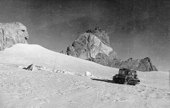
Polaris travel to Mount Lacey
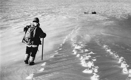
The late Bill Cartledge and our previous day’s footsteps in the snow
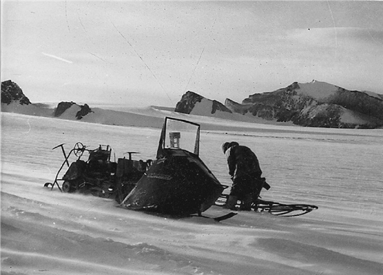
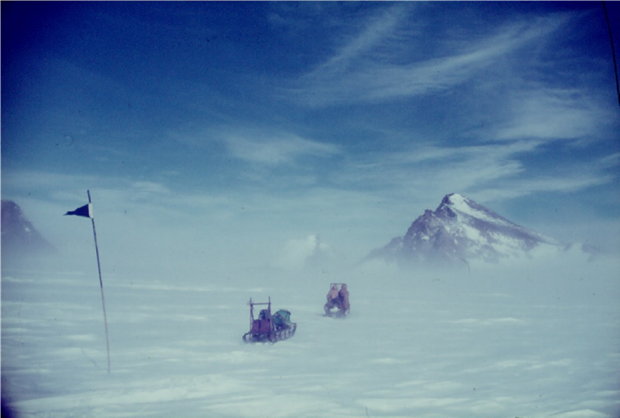
Polaris on the Scylla Glacier
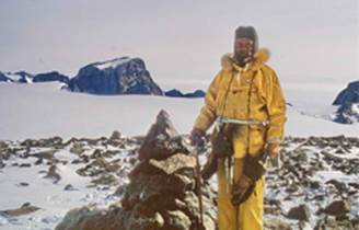
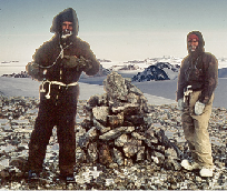
(Left) Max Jones on Leah Ridge with stone cairn;
(Right) Max Jones & I at cairn on peak of Mount Béchervaise
(photos by Max Cutcliffe).
SUMMARY
SURVEY
(a)Tellurometer
The trip commenced with the operation of the Tellurometers still a doubtful quantity, and for this reason it was decided to bypass the difficult line from Depot Peak to Peak Seven for the time being as an unsuccessful attempt there would still not clearly indicate whether the fault was in the line conditions or in the instruments,. So the line Peak Seven to Mount Shaw was selected for the first attempt and this turned out successfully. Although measurements were obtained from Depot Peak to Mount Wishart, the instruments continued to behave in a number of peculiar ways, which, although not affecting the accuracy of the measurements, made the work so much more difficult.
Temperatures during the times of measurement varied from -10°F to +10°F, and so were not too severe on the batteries. The TAS generators were not required during the trip but five batteries were in use so that the forward operator took three fully charged batteries, leaving the main party with the two fully charged batteries and the main generator and battery charger with the Workshop Caravan. These proved quite adequate and only on a few occasions were the second batteries required, and these were usually found to be due to improper charging before departure. Insulated boxes were made for the batteries but were found to be not of great value, for if the batteries are with the main party they can be kept charged up until the last minute, and if with the Snotrac party then they are exposed to the low temperatures for such a time that the insulation is ineffective. They were tried with handwarmers placed on either side of the insulated box but although it is very difficult to pronounce anything definite as to their effectiveness it would seem that the awkwardness of the boxes does not justify their use – at least, not if there is any difficult climbing involved as the box must be kept with the battery upright which makes the box wider than its height, measuring 14” x 18” x 15” deep.
Ground swings were large on the lines from peak to peak but this was to be expected owing to the nature of the lines and the impossibility on all peaks of selecting good sites in more than one direction that is, most peaks consist of a steep slope rising to a crest which falls away to a sheer precipice. Ground swings were as follows :
|
LINE |
|
MEASUREMENTS |
|
|
|
1 |
2 |
3 |
4 |
|
|
Depot Peak - Glaciology 3 |
2.25 |
2.75 |
1.75 |
2.75 |
|
Glaciology 3 - Glaciology 2 |
1.75 |
1.25 |
1.75 |
2.75 |
|
Glaciology 2 – Glaciology 1 |
1.25 |
1.75 |
1.25 |
1.50 |
|
Glaciology 1 – Peak Seven |
6.50 |
7.25 |
7.75 |
6.50 |
|
Peak Seven – Mt Macklin |
9.50 |
8.75 |
12.00 |
10/75 |
|
Mt Macklin – Mt Lacey |
13.50 |
12.00 |
12.75 |
13.50 |
|
Mt Lacey – Mt Wishart |
1.75 |
2.50 |
2.75 |
1.75 |
In measuring to the surface Ice Stations, Glaciology 1 and Glaciology 2, the Tellurometer was operated most satisfactorily from the roof of the caravans, having to split the caravans for the measurement G1 – G2. The line G2 – G3 was only about 1½ miles long due to the sharp fall of the surface and so the measurement was made from the roof at G2 and to the ground at G3.
The measurement from G3 to Depot Peak was first attempted with the instrument on the ground but as the signal was so weak it was shifted up onto the roof of the Snotrac and this made quite a significant difference. The large reflector dishes were used at all times.
(b) Angular Measurement
(i) Horizontal
Permanent beacons were erected on the four peaks selected for use as control points. Because of the longer sights, two-drum beacons painted black were erected on Peak Seven and Mount Shaw while the standard Mawson-type beacon was erected on Mount Lacey and Mount Wishart, all peaks having good solid rock for guying points. Four foot high stone cairns were erected on Mount Starlight, Mount Béchervaise and Leah Rock and these were subsequently intersected. Shimmer and haze affected most sightings but only at Glaciology 3 was this a real problem with sightings to Peak Seven and Depot Peak very poor, probably due to the long grazing ground rays. The method of pointing was to use double pointings on each target sighted using the 40x eyepiece. At least two sets were obtained using the Wild T3 at all stations except Peak Seven where bad weather forced a stop after only obtaining one set. It would also be advantageous to have read the angle Depot Peak to Mount Shaw from here but cloud cover on Depot Peak prevented this at the time. In good conditions the beacon at Depot Peak is clearly visible from Peak Seven but these conditions are probably fairly rare. Presumably re-measurement will be made in the near future to the glaciological markers from Peak Seven and Mount Shaw and this opportunity could be used to tie up this station more effectively. Thirteen surrounding peaks were intersected but two of these only by a single theodolite ray, the second intersection being made photographically. These were Mount Jacklyn and Riddell Nunataks. Mount Jacklyn was sighted from Mount Wishart only, it is probably visible from Mount Macklyn but could not be identified at the time. Riddell Nunataks was intersected from Peak Seven but from Mount Macklin by photo intersection only.
Three surface stations were used over the ice between Peak Seven and Depot Peak, these consisting of two-drum welded beacons painted black with a length of bamboo in a drill hole in the ice adjacent to the beacon. These made quite good sights over long distances but fairly poor over the short line G2 to G3, but as the beacon width just overlapped the split vertical crosshairs sightings were quite adequate.
(ii) Vertical
Reciprocal Vertical angles were obtained between most control points but owing to lack of training of T2 operators the sights from Peak Seven to Mount Macklin were very poor due to incorrect method of observation. The sights from Depot Peak to G3 were also of little value due to a fault which developed with the Alidade Bubble. This was offset to some extent by later reading verticals with the T3 to Max Corry’s last beacon and at the same time to G3 to obtain the refractive coefficient.
(iii) Astronomical
It was intended to obtain these astros at an easily accessible control point such as Mount Macklin or Peak Seven. Instructed to remain at Weasel Gap and obtain them from Mount Lacey, we wasted sixteen days unsuccessfully waiting for suitable weather and were forced to move on and could only obtain solar observations at Mount Macklin and Depot Peak. At Mount Macklin four Prime Vertical pairs were observed to the sun in the east, where although the altitude is fairly low (30 deg) the rate of ascent is the greatest. At Depot Peak two sets of four pairs were obtained in the east and two sets of Prime Vertical pairs in the west, the two sets being spaced about an hour apart. Azimuth, altitude and times were observed to give a longitude as well.
(c) Terrestrial Photography
At each control station a round of terrestrial photos was taken at 45° intervals with the Survey Camera mounted on the T2 theodolite. There was no filter with this camera but the Nikon filter was hand held in front of the lens. A round was also taken with the Nikon on B&W FP3 film using the zoom lens at wide angle and the dark yellow filter, then changed to long focal length for identification photos of intersected points. A round was also taken using Agfa CN17 colour negative film.
These films are indexed as follows :
120mm Glass plate HP3 Exposed as 300 ASA with ½ stop filter correction.
Set of eight plates – QP1, QP2, QP3, etc.
35mm B&W FP3 Exposed as 80 ASA with ½ stop filter correction
Cassette of 20 - Q1, Q2, Q3, etc.
35mm Colour Negative CN17 40 ASA
Cassette of 12 QC1, QC2, QC3, etc.
I found the Nikon an awkward camera to use and virtually impossible with gloves on. The straps on the compartment case broke off before arrival at Mawson and as the eveready case will not fit over the zoom lens it was most inconvenient. Nevertheless, the results it produced were quite OK except for an occasional chopping off of the corners.
On return to Mawson the 35mm B&W film was developed and 620 size prints made as index photos. These were then numbered on the reverse with the cassette number followed by the exposure number from the edge of the film:- Q3/5, Q3/6, Q3/7etc. These were then used to select the best frames for enlargement of the intersected points for identification. They also facilitated sorting of prints from the plate and colour negs in Melbourne.
NAVIGATION
The existing 1:100 000 scale compilation sheets made navigation a very simple matter, although all due care is still necessary; it is almost possible to navigate from the maps alone – in good weather! As we had very little good weather, navigation was mainly by Astrocompass and distance, estimated from time travelled, searching for the forward marker with the binoculars if not visible to the naked eye. All navigation was done by myself, which was a little awkward as I was not driving, and as was discovered on the Autumn trip, this was not a very satisfactory arrangement. Only having one navigator precluded any 24 hour continuous driving, although this rarely worried us as the weather seldom stayed drivable for that long anyway.
The floating magnetic compass was used all the time in the D4s and found a great help. On odd occasions apparently the compass direction slowly turned nearly 120 degrees before the driver saw the rear train approaching from the side. If drivers can learn to travel by magnetic compass in conjunction with the sun, wind and sastrugi direction, less trouble will be had with major errors.
On the return journey from Weasel Gap, bamboo canes were placed at 15 minute intervals of D4 travel, approximately ¾ mile apart. A drum was placed at every third cane and an aluminium number tag attached to the cane commencing with Q1 about 2 miles from Weasel Gap Depot and increasing numerically. The routes used were easily identifiable from the surrounding peaks and at each drum astrocompass bearings were read to three surrounding peaks for later resection. All the drums placed in 1966 were painted black and this is a very worthwhile occupation if it could be done during the winter before leaving. Where possible on the old marked route from Peak Seven to Depot Peak (Rum Depot was shifted to a rock outcrop just west of Peak Seven) and from there back to Twintop all snow-buried drums were lifted out and replaced on the surface. The crevassed area between Fang Peak and Painted Peak was free from snow on the return trip but we travelled about 400 yards further south and saw no dangerous crevassing, probably it changes considerably even from year to year. At no stage on the return journey were the outward tracks visible enough to follow, but visibility was better and navigation was mainly by binoculars and map. The Snotrac trip gauge was checked against the Tellurometer measurement and found that one Snotrac mile equals 0.598 statute miles, say 0.6 miles.
A safe driving route for D4s was found to and beyond Weasel Gap as far as Moore Pyramid and Mount Wishart. A large flat crevasse-free area of blue ice exists to the east of Moore Pyramid about one mile square, which should be very suitable for landing aircraft. If extensions of the work are to be considered from either surface or air the prospects look quite promising, as probably the best place to cross the Scylla Glacier is south or southwest of Mount Wishart.
GEOLOGICAL
A number of rock outcrops were visited for the first time south east of Mount Lacey, the main one being Mount Wishart. In searching for a suitable site for the control point a number of other peaks were visited but rock samples were only collected from Mount Wishart, which was surveyed in detail. Collections were also made to the east of Mount Lacey from Leah Rock, the small pair of rocks north of Mount Peter and from Mount Lacey and Mount Shaw. A number of colour photos were taken of the various outcrops.
TRANSPORT
Apart from the D4 tractors, which seem a very reliable vehicle and well adapted to the requirements here, the other vehicles leave much to be desired. One Snotrac gave continuous trouble, mostly of a minor nature, but nevertheless causing much inconvenience. After leaving Weasel Gap Camp for Mount Wishart with the two Snotracs we had four holdups in eight miles with the one vehicle before the drive housing cracked and stopped it altogether. From here on the work program had to be curtailed as the only other means of transport into Mount Wishart and beyond was the Polaris and to go further would have made a big job of reclaiming the equipment in the event of a breakdown of the second Snotrac. The sastrugi south of Weasel Gap was up to three feet high. Fortunately, the remaining Snotrac did an excellent job towing back the sled of gear as well as the other Snotrac on a Norwegian sled and then did another 200 odd miles without any trouble.
The Polaris also gave a lot of trouble, particularly with the automatic clutch and in starting, and having a rope start makes this more apparent. On one occasion after working all day on Mount Lacey, having made three trips up the mountain with heavy packs, two of us had to pull the rope starter for two hours, and then with no success, walk back the three miles over dangerously crevassed country at 0400h the following morning.
COMMUNICATIONS
Communications with Mawson during the stay in the field were excellent and only on one or two occasions were conditions bad enough to prevent traffic. In the field it was not so good, the two ANGRC 9 transmitters in the Snotracs ceased functioning properly in the early stages of the trip and most communications were then via the Vaughan Walkie-Talkies. These proved invaluable and particularly in conjunction with the Tellurometer work. With the numerous troubles experienced with the Tellurometers, I am sure we could not have completed half the amount of work we did if it were not for the radios within easy reach of the Tellurometers. We had the arrangement, that if the Tellurometer contact was lost for more than five minutes to then switch to the radio, and this saved the Tellurometer batteries a great deal of wastage. The radios were used with the ground dipole and although this could not always be correctly laid it nevertheless gave good results up to 30 miles. Eventually these too, ceased to function properly but by relaying messages via the radio operator in the caravan, we just managed to last the job out. Good handy communications apart from the Tellurometers are certainly a must for success in this work.
WEATHER
The weather during the trip left everything to be desired and was certainly nothing like that shown in the travel brochures. Out of 114 days away from Mawson, 59 were untravelable and unworkable due to snow or drift and only 36 days of clear sky suitable for astros if they came at the appropriate time.
WEATHER SUMMARY
11 October 1966 to 27 January 1967 – Official Meteorological Data
|
RECORD |
OCTOBER |
NOVEMBER |
DECEMBER |
JANUARY |
|
Highest Max Temp °F |
- 3.9 30th |
+ 9.3 17th |
+ 15 29th |
+12.7 11th |
|
Lowest Max Temp °F |
- 16.5 21st |
- 10.8 6th |
+ 4.4 5th |
+ 8.5 14th |
|
Highest Min Temp °F |
- 12.4 18th |
+ 1.5 17th |
+7.5 29th |
+ 8.5 10th |
|
Lowest Min Temp ° F |
- 36.2 27th |
- 29.5 7th |
- 4.6 23 & 27 |
- 8.4 14th |
|
Mean Max Temp °F |
- 12.3 |
- 1.0 |
+8.9 |
+11.1 |
|
Mean Min Temp °F |
- 28.4 |
- 11.1 |
0.0 |
- 0.6 |
|
Average Temp °F |
- 20.3 |
- 6.0 |
+4.4 |
+5.2 |
|
Mean R.H. % |
66 |
62 |
74 |
78 |
|
Days of snow |
6 |
6 |
16 |
15 |
|
Days of drift |
17 |
12 |
21 |
21 |
|
Days of Gale wind 33knots + |
1 |
2 |
7 |
10 |
|
Days of strong wind 22knot + |
14 |
15 |
13 |
20 |
|
Total wind run Miles |
- |
- |
14,272 |
17,154 |
|
Highest wind run Miles |
- |
- |
766 29th |
1,142 19th |
|
Mean wind speed Knots |
- |
- |
16.7 |
23 |
|
|
|
|
|
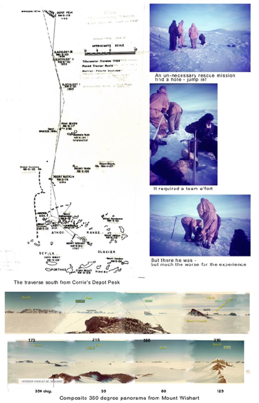
Maps showing routes of 1966 survey trips |
||
APPRECIATION
Despite continuous bad weather, the amount of work completed was most satisfying and makes one wonder what might have been achieved had the Met man been doing his job properly and favoured us with some fine weather. To the success of the trip much credit must be given to Allan Williams and Ron Murray who spent a large amount of their time before we left in repairing dipoles and adjusting strange electronic devices in the Tellurometers, for without these the trip could have achieved little. To those who got the equipment in working order before we left, much thanks is due.
Max Cutcliffe, a great companion who did a very thorough job with the field store equipment and missed nothing on the food side. Valuable assistance with D4 driving, radio operation, instrument work and recording as well as provision of some great photos.
Max Jones kept our transport operational during the trip and got us there and back with a minimum of fuss, but this was also the result of many weeks of work prior to the trip.
Thanks to the vehicle drivers of the different types of vehicles available to see us reach our destination and to Gordon Whitehouse the radio operator who maintained our contact with Mawson.
To all those who assisted in booking and backpacking heavy loads up many hills and learning new skills in operation of the different pieces of survey equipment, nothing could have been achieved without such teamwork – I thank you all.
A particular personal thanks and appreciation goes to the support I had from Max Cutcliffe, Max Jones and Gordon Whitehouse during the Spring Traverse.
Survey Project 1/1966 : Determination of Azimuth at Twintop
February 1966 - February 1967
Aim
To connect azimuth of 1965 Tellurometer Traverse to Depot Peak to the existing triangulation of the Frammes Mountains
This work which was intended to be carried out during the 1965-66 changeover period, could not be carried out owing to the unavailability of the Bell Helicopter.
The program was then deferred, to be attempted through the year by surface vehicle - firstly in conjunction with the glaciological work at Casey Range - and then with further attempts throughout the year. Details of these trips are found in the 1966 Survey Reports February 1966 to February 1967.
Survey Project 1A/1966 : Determination of Azimuth at Twintop;
in conjunction with Glaciological work at Casey Range
18-28 February 1966
Aims
To assist glaciologist in setting out and staking strain grids in the area east of Casey Range
When no longer required by glaciologist, to travel to Lucas Nunatak and erect beacon
At Lucas Nunatak to read horizontal and vertical angles to Bechervaise Island, Onley Hill, Van Hulssen Nunatak and Mt. Twintop
Summary
Not all survey related work was completed due to time constraints.
Survey Project 1B & 1C/1966 : Determination of Azimuth at Twintop;
6-10 & 21-25 April 1966
Aims
At McNair Nunatak to read the horizontal angle between Painted Hill and Mt. Twintop
To read reciprocal vertical angles between Painted Hill and McNair Nunatak.
To measure the Tellurometer line Painted Hill to McNair Nunatak.
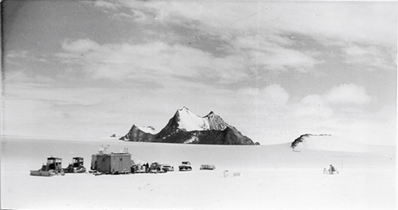
The camp at McNair Nunatak
Summary
Survey equipment and communication’s malfunction saw work incomplete during 6-10 April.
During period 21-25 April various malfunctions and weather saw work incomplete.
Survey Project 1D/1966 : Determination of Azimuth at Twintop;
25 May – 2 June 1966
Aim
Re-erect beacon at Painted Peak
At McNair to read horizontal and vertical angles to Anniversary Nunatak, Mt Twintop, Van Hulssen Nunatak, Painted Peak, Onley Hill
Time and weather permitting at Onley Hill to read horizontal and vertical angles to McNair Nunatak, Anniversary Nunatak, Painted Peak
Summary
Blizzard conditions and communications failure prevented work.
Copy of Report (edited)
Survey Project 1E/1966 : Bechervaise Island Astro & Trig Observations
August 1966
Aims
To determine, by balanced stellar observations, the geographical position of Béchervaise Island Station NM/S/54 using the Ney Method for at least one set of observations.
At Béchervaise Island :
To determine by balanced stellar observations, the azimuth of the line
Béchervaise Island to Onley Hill; and
To read horizontal and vertical angles to Goldsworthy Ridge, Onley Hill, Painted Hill and Lucas Nunatak.
Summary
Two theodolites were used for daylight observations, the Wild T3 being used for the actual observing and a Wild T2 used for holding the position of the star to enable changes of face to be made during observation. This method was suggested by Corrie and proved very satisfactory. Also, as the greatest difficulty is still in changing face, particularly in extreme cold, the number of changes of face is best kept to a minimum.
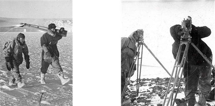
(Left) Ron Murray and I out for a walk over the sea-ice to Béchervaise Island;
(Right) Using two theodolites - T3 & T2 for Daylight Star observations.
Copy of Report (edited)
Survey Project 1F/1966 : Determination of Azimuth at Mount Twintop
6 – 16 September 1966
Aims
To determine Twintop azimuth by either :
Tellurometer distance McNair – Painted Peak
Horizontals at McNair to Twintop – Painted Peak
Horizontals at Painted Peak to McNair – Onley Hill
OR
Horizontals at McNair to Anniversary Nunatak, Painted Peak, Twintop, Van Hulssen, Onley Hill
Horizontals at Painted Peak to McNair, Onley Hill, Van Hulssen
Horizontals at Onley Hill to McNair, Anniversary Nunatak, Painted Peak, Van Hulssen
depending on successful operation of repaired Tellurometers
Summary
Although sighted well by Max Corrie last year from Twintop, the line Twintop – McNair appears very difficult. This year, twenty one days have been spent at McNair during April, May, June and September and on no day was any beacon visible other than Onley Hill.
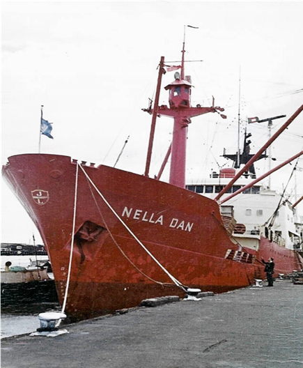
MV Nella Dan North Wharf, Melbourne.
EQUIPMENT
|
SURVEY |
|
|
1 |
Theodolite T3 c/w Tripod, plumbob and transport box |
|
2 |
Theodolite’s T2 c/w Tripod, plumbob and transport box |
|
3 |
Theodolite Lighting sets T2 – T3 |
|
|
Spare batteries for lighting sets |
|
|
Spare globes for lighting sets |
|
4 |
Heliographs c/w tripod, Lucas lamps and spare globes |
|
7 |
Mountain Mule packs |
|
2 |
100 ft box tapes |
|
1 |
100 ft band |
|
8 |
12v batteries (4 dry charged) c/w boxes |
|
1 |
Chronometer c/w insulated box and hot packs |
|
2 |
Heuer Stopwatches |
|
3 |
Binoculars |
|
3 |
Astrocompasses c/w mounts fitted to vehicles |
|
3 |
Prismatic compasses |
|
1 |
Floating box compass for D2’s |
|
1 |
ANARE Angulon Survey Camera c/w KP3 Glass plates |
|
1 |
Nikon camera c/w film |
|
1 |
Curta hand calculator |
|
1 |
Slide rule |
|
1 |
Photo Identification Kit |
|
6 |
Psychrometer thermometers c/w cases |
|
3 |
Tellurometers c/w tripod, rucksack and transport box |
|
3 |
Altimeter batteries |
|
3 |
Combination protractor/parallel rules |
|
3 |
6inch scale rules |
|
1 |
Multimeter |
|
|
|
|
GENERAL |
|
|
5 |
Beacons and tools plus guys and pins for 3 drum beacons |
|
2 |
Cobra rock drills c/w bits |
|
1 |
1inch star drill |
|
|
80lb Sulphur (2 sugar tins) 1½ lb/hole 8 beacons – 32 holes |
|
100 |
Marker flags and bamboo poles |
|
|
1 gallon Black paint |
|
|
Station number tags and route marker pole tags |
|
|
3 TAS Mini-generators |
|
1 |
Geological hammer |
|
|
Geological specimen bags, tags, etc. |
|
6 |
Climbing ropes |
|
|
Crampons |
|
|
Ice axes |
|
20 |
Pitons for eccentric marks |
|
|
Ice drill |
|
1 |
6lb hammer |
|
|
|
|
STATIONERY |
|
|
|
Clutch pencil lead refills |
|
|
Rubbers |
|
|
Arnos pens |
|
|
Note pads |
|
|
Chinagraph pencils |
|
|
Ballpoint pens |
|
|
Shortredes Tables |
|
|
Chambers 7 Fig Logs |
|
|
2 Nautical Almanacs |
|
|
Astronomical Ephemeris |
|
|
Star Almanac |
|
|
Star Chart |
|
|
|
|
|
Field Books – Tellurometer |
|
|
Azimuth |
|
|
Trigonometrical |
|
|
Astronomical |
|
|
Geological |
|
|
Tellurometer Reduction Charts |
|
|
Astro and Trig Summary Sheets |
|
|
Trig Station diagrams – Eccentrics |
|
|
Control Station Record Book |
|
|
Navigation Tables |
|
|
Maps |
|
|
Graph pad |
|
|
Astro Position from Stellar Azimuths - Ney |
|
|
Geodesy notes |
|
|
Survey Instructions |
|
|
Tellurometer Handbooks and notes |
|
|
Wild T2 – T3 Handbooks and Maintenance Manual |
|
|
Antarctic Name Proposal Forms |
|
|
Astrocompass Operation Instructions |
|
|
Tellurometer Operation Instructions |
|
|
Theodolite Operation Instructions |
|
|
Radius of Curvature Tables |
|
|
Time Signal Information |
|
|
Survey Photos – Aerial and Terrestrial |
|
|
|
|
|
|
|
|
The Bulova ‘Accutron’ ‘Nardin’ Ulysses Deck Watch |