 |
||
|
| People | | Photos | | Documents | | Operations | | Videos |
| ALS/ACRES | | NatMap in PNG | | Aircraft Support in Antarctica |
|
About
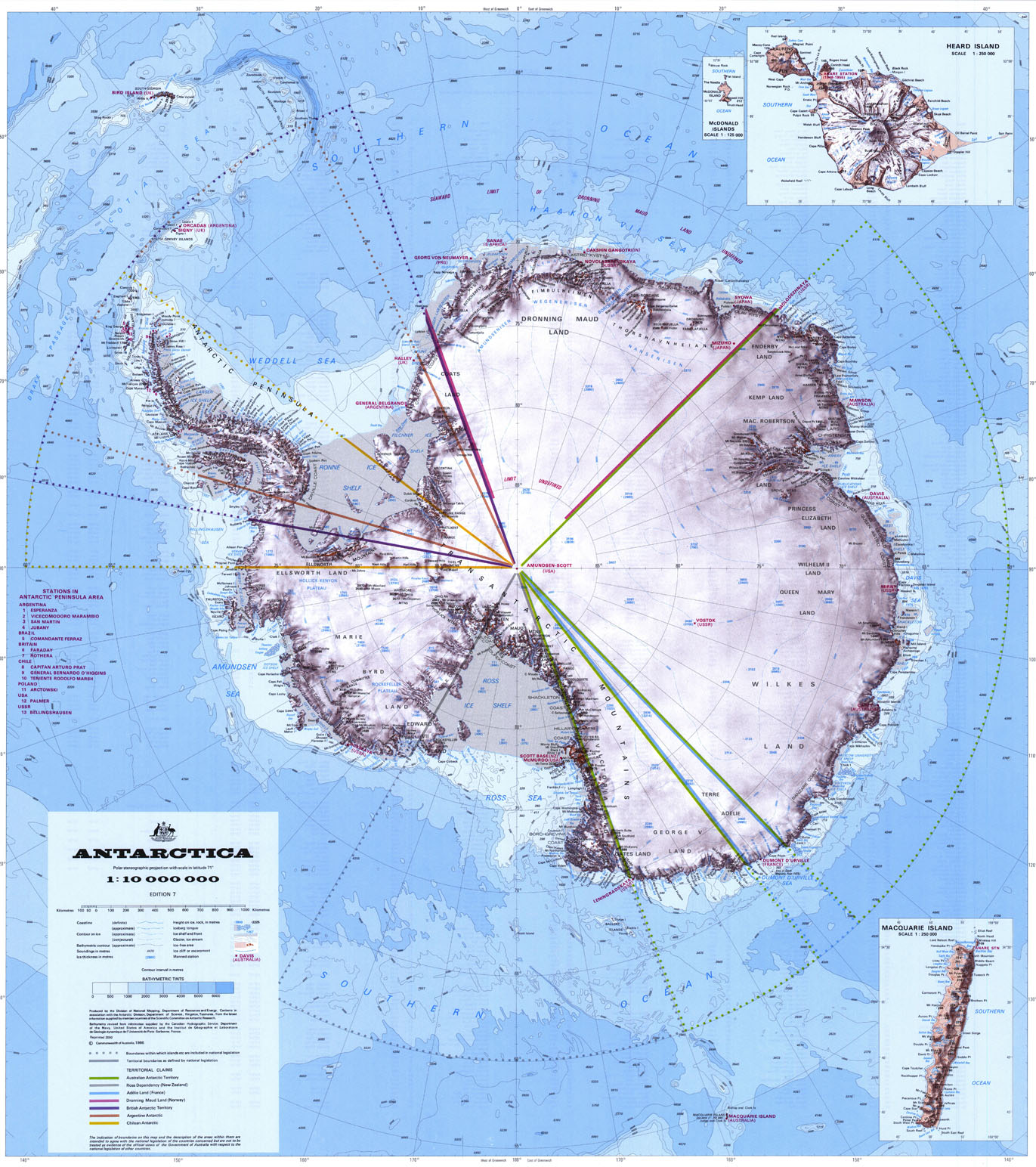
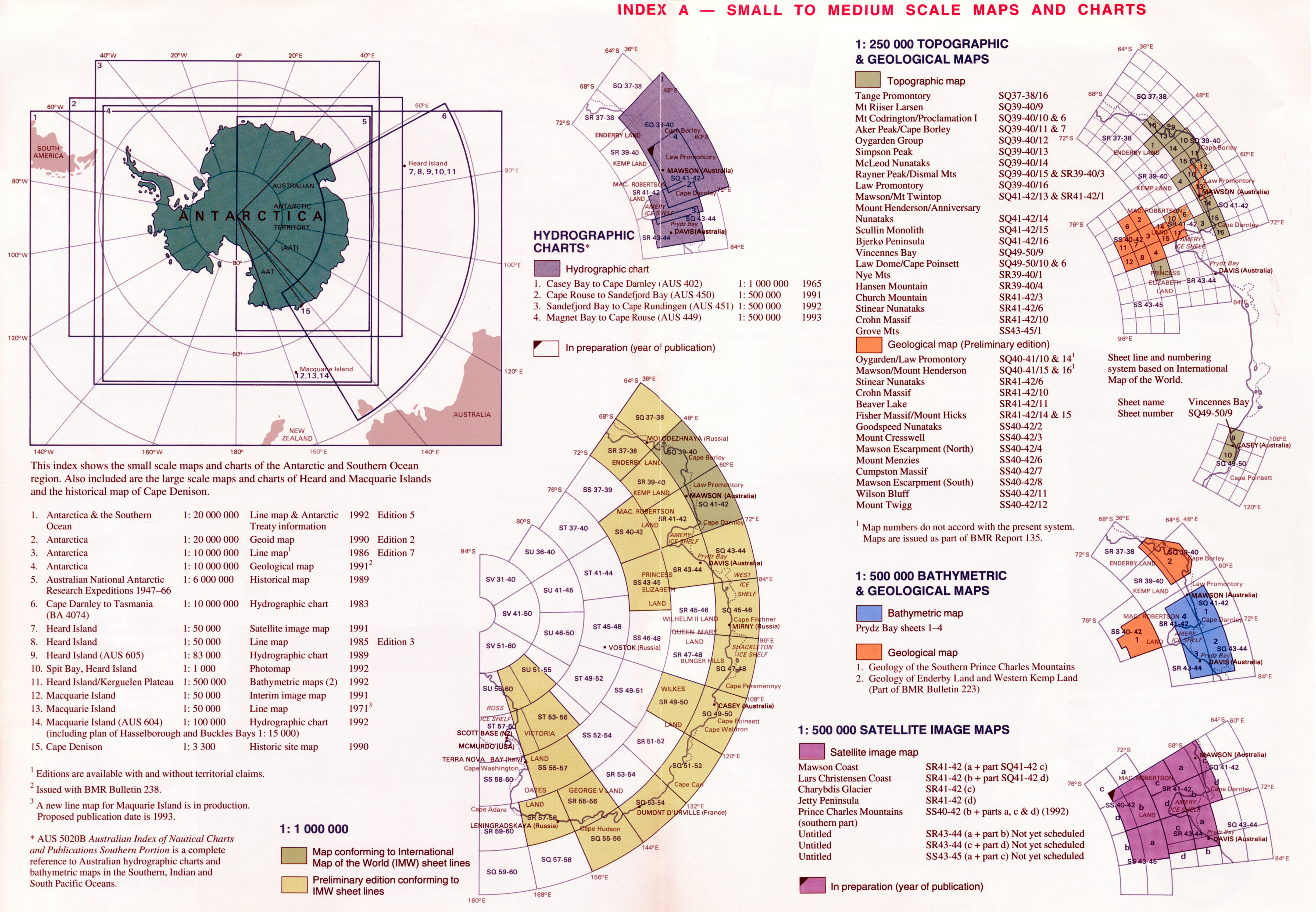
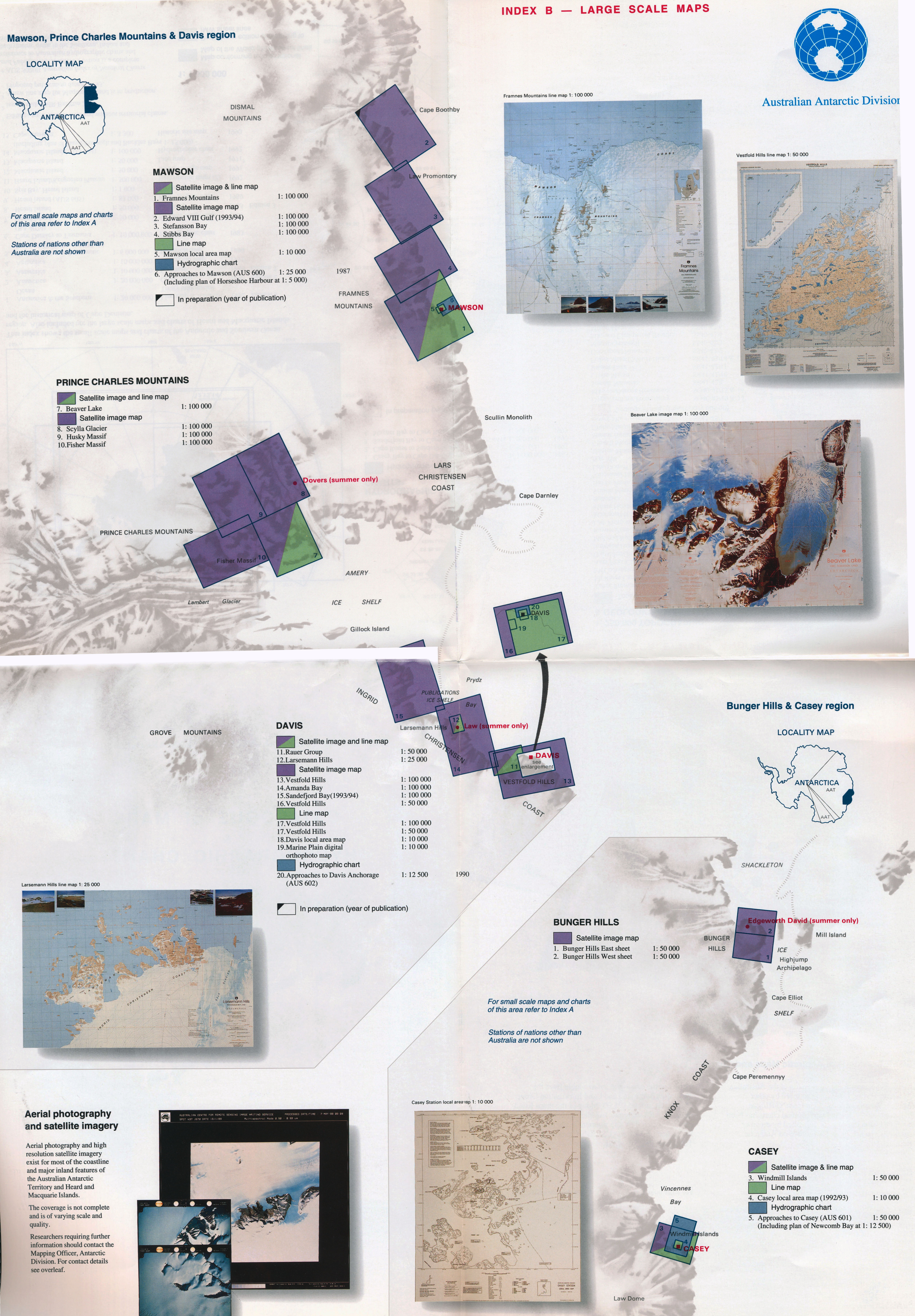
National Mapping was involved in surveying, mapping and aerial photography activities
in the Australian Antarctic Territory (AAT), Heard and McDonald Islands and Macquarie Island throughout the 1960s, 70s & 80s.
Accounts of these activities is documented here.
|
|
|
|
|